2 DaysSolo Traveler4 Stops

Mark Twain National Forest (North section), Missouri

2-Day Itinerary for Solo Traveler

Turquoise Water & Quiet Trails: A Solo Ozark Escape

Turquoise Water & Quiet Trails: A Solo Ozark Escape

The northern Ozarks don't announce themselves — they seep in slowly, through the mineral hush of a spring pool or the way morning light pools on turquoise water. This is a landscape built for solo pacing: no crowds to negotiate, no schedule but daylight and water clarity.

At a Glance

Climate & Weather
Spring days run 56–66°F with real swings — mornings can feel raw, afternoons mild. Rain is likely at some point; pack a waterproof shell, quick-dry layers, and sturdy water shoes since creek crossings and spring overlooks both involve wet rock.
Getting Around
A car is essential — distances between clusters run 30-60 minutes on rural highways, and there's no public transit. Roads are well-maintained but forest access roads can turn muddy after rain, so a vehicle with decent clearance helps.
Budget
Budget roughly $60-90/day for a solo traveler — modest diner meals, a canoe or kayak rental if paddling, and minimal park fees. Outfitter day rentals are the biggest single expense.
Safety
Solo travelers should note trailheads and river access points can be remote with no cell service — tell someone your route and expected return time. Water is cold and currents on the Eleven Point can be swift even when the surface looks calm; avoid entering swollen water after rain. Snakes and black bears exist here but are rarely encountered if you stay on marked paths and store food properly.
Connectivity
Expect spotty to nonexistent cell coverage once you're off the highway and into forest access roads. Download offline maps before you leave Salem or Van Buren, and treat any signal at a trailhead as a bonus, not a guarantee.
Local Tips
Arrive at Blue Spring before 9am on weekends — it's a compact, photogenic spot that fills quickly once day-trippers arrive. Outfitters in Van Buren are genuinely social hubs; solo travelers can often join a shared shuttle or chat with other paddlers waiting to launch. Check with outfitters the morning of for water levels — spring rain can change conditions overnight.

Highlights

  • Standing alone at Blue Spring before the first weekend crowd arrives
  • Wading the limestone-cooled creek along Lost Valley Trail
  • Paddling the jade-green Eleven Point River at your own rhythm
  • Watching mist rise off Greer Spring in late afternoon light
  • Trading trail notes with fellow paddlers at a Van Buren outfitter
  • Wildflowers threading the forest floor in peak spring bloom

Day-by-Day Plan

Arrival & gentle immersion

Day 1: Settling In: Springs and Quiet Water

A low-key first day exploring the intimate Blue Spring Valley on foot, roughly 3-4 miles of easy-to-moderate walking with plenty of pauses for photography and rest.

Wear
Waterproof hiking shoes or sandals with grip, moisture-wicking layers, a packable rain shell, and a hat — mornings can be cool and misty near the spring.
Budget
$35-50 (breakfast, packed lunch, no entry fees for this cluster)
7:30 AM - 8:30 AM
Blue Spring · morning · 60 min · Blue Spring Valley

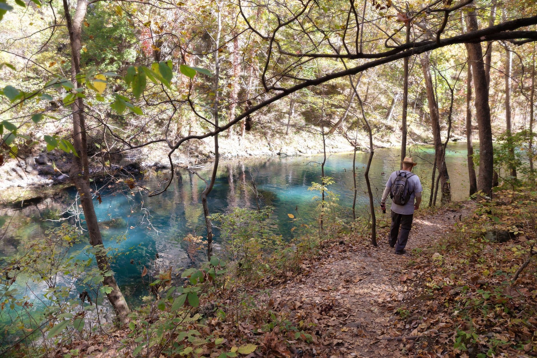
Arrive by 7:30am and the spring is yours — just birdsong and the faint trickle of water easing out of limestone fissures. The color is almost unbelievable: a turquoise so saturated it looks lit from within, deep enough in places that the bottom disappears into blue-black shadow. Solo travelers get an easy, contemplative start here; there's no rush, no crowd to navigate, just a bench-adjacent overlook and thirty feet of visible clarity to sit with.

Blue Spring
U.S. Fish and Wildlife Service - Midwest Region / wikimedia (Public domain)
Shoot from the overlook vantage point around 8am when soft morning light hits the water without harsh glare — midday sun flattens the color.
Uneven, unpaved terrain around the spring basin; sturdy footwear recommended, no wheelchair access.
15 min walkA short walk along the forest access path connecting the spring overlook to the trailhead, the sound of the spring fading behind you as birdsong takes over.
9:00 AM - 11:00 AM
Lost Valley Trail · midday · 120 min · Blue Spring Valley

The trail threads a narrow limestone valley, creek crossings underfoot and cascading spring water cutting through oak and hickory just greening up with spring growth. Wildflowers are likely blooming along the banks this time of year. Solo hikers should move at a relaxed pace here — the swimming holes invite lingering, and weekday mornings mean you'll likely have long stretches of trail to yourself.

Lost Valley Trail
Photo by Deb Hayes on Pexels
The main swimming hole reflects the limestone bluffs beautifully around mid-morning — arrive before 10am for still water and soft light.
Uneven trail with creek crossings; not suitable for wheelchairs or those with mobility limitations.
If it rains: Light rain is manageable at both Blue Spring and Lost Valley Trail — the water's color actually deepens in overcast light. If rain is heavy, creek crossings on Lost Valley become hazardous; stick to the Blue Spring overlook only and reschedule the trail for tomorrow's window if conditions allow.

The day opens quietly at Blue Spring, arriving early enough that the mist hasn't burned off and the water holds that impossible turquoise glow all to itself. It's an easy, grounding way to start — no itinerary pressure, just cool air, mineral-scented water, and time to adjust to the forest's slower rhythm.

From the spring, a short walk leads into Lost Valley Trail, where the terrain shifts from stillness to gentle motion — creek crossings, cascading water, and limestone bluffs rising on either side. The trail rewards an unhurried pace; solo travelers can pause at each swimming hole as long as they like without coordinating with anyone else's schedule.

With no dining data pinned to this specific cluster, plan your evening meal back in Van Buren or Salem rather than at the trailhead — both towns offer the classic Ozark diner and barbecue fare the region is known for, and arriving before 8-9pm ensures kitchens are still open. It's a good night to rest early; tomorrow's river day asks more of the legs and arms.

Water and motion

Day 2: On the River: Eleven Point Immersion

A fuller day centered on the Eleven Point River corridor, combining scenic river time with paddling — expect 2-4 hours on the water and light walking, roughly 2-3 miles total.

Wear
Quick-dry clothing, water shoes or secured sandals, a hat, sunscreen, and a dry bag for valuables — layer with a light jacket for cooler morning air on the water.
Budget
$70-100 (canoe/kayak rental, lunch, incidentals)
45 min driveA quiet backroad drive from the Blue Spring Valley area toward the river corridor, forest thinning occasionally to reveal Ozark ridgelines — a good stretch to catch a coffee-and-scenery breather if it runs over 60 minutes depending on your overnight base.
7:30 AM - 10:30 AM
Eleven Point River · morning · 180 min · Eleven Point River Corridor

Early morning is when this river shows its best self — jade-green water moving almost silently over limestone, sycamores leaning in from the banks, and a stillness that by mid-morning gives way to more paddlers and voices. Launching by 7:30am means solitude and the best water clarity of the day; it's also the safest window for solo paddlers, with calmer conditions and outfitter staff nearby to check in with before you go.

Eleven Point River
Unknown / wikimedia (Public domain)
The Eleven Point access near Highway 160 offers sycamore-framed views best photographed in the soft, low light of early morning before 9am.
Uneven riverbank access; paddling requires moderate physical ability and is not wheelchair accessible.
20 min driveA short drive downriver to the outfitter access point, gravel crunching underfoot as the canyon walls start to close in.
11:00 AM - 1:00 PM
Current River Outfitters & Paddling Access Points · midday · 120 min · Eleven Point River Corridor

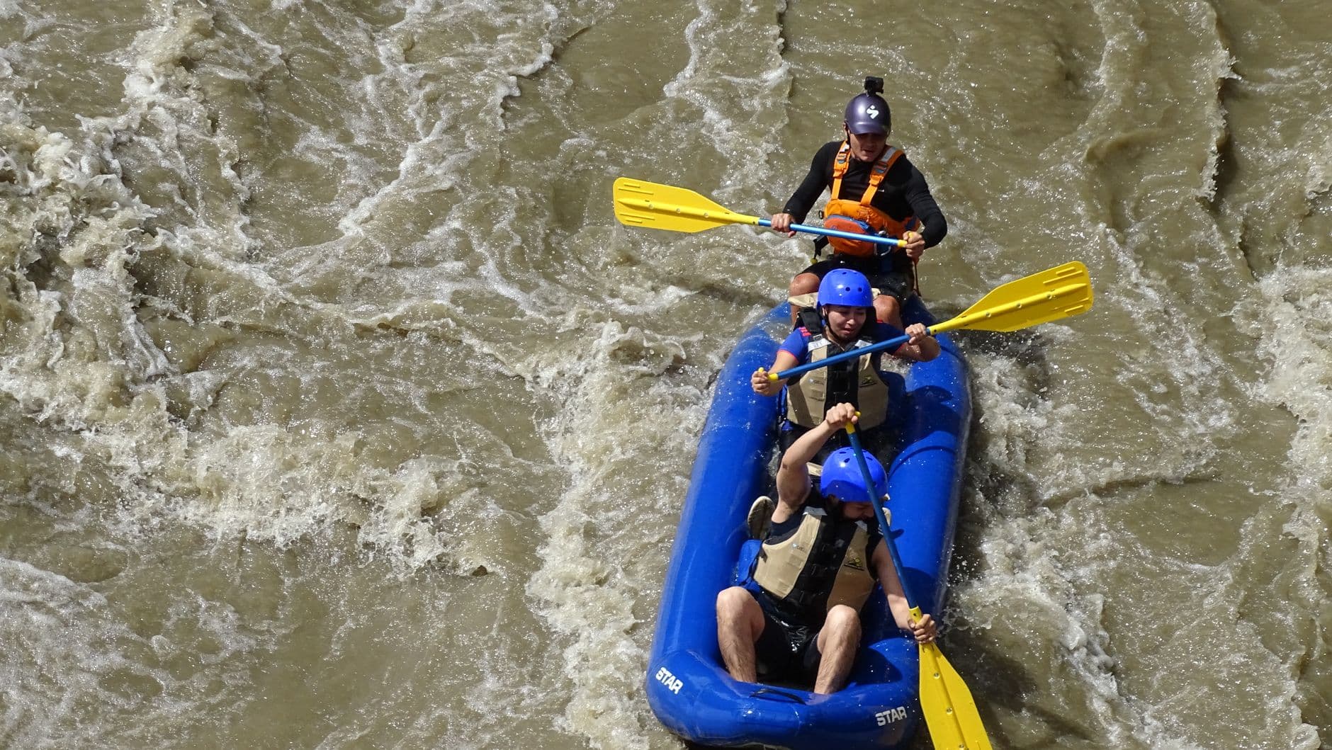
This is the social heart of the day — outfitter staff, fellow paddlers comparing notes on the morning's run, and the low hum of gear being loaded and unloaded. For solo travelers, it's an easy, natural place to strike up conversation over a shared launch or a post-paddle break; many outfitters coordinate shuttles that put you alongside other travelers. The limestone canyon walls rising overhead make for a dramatic midday backdrop even if you're just resting here rather than paddling further.

Current River Outfitters & Paddling Access Points
Photo by RAFTING CHICAMOCHA on Pexels
Bluff overhangs and river bends around mile 3-5 of standard routes photograph best in midday light when the canyon walls are fully lit.
Viewing areas near the outfitter are more accessible than the water itself, but paddling requires standard mobility and swimming ability.
Optional detour: Greer SpringAfter Current River Outfitters and before returning to lodging
If time and energy allow, Greer Spring offers a moderate-energy add-on with dramatic scale — 360 cubic feet of water per second emerging from limestone, and a good late-afternoon light window for photography. Skip if: It's a further drive south into a separate cluster, and after a full morning of paddling, solo travelers prioritizing rest may prefer to skip it and head back early instead.
If it rains: If heavy rain swells the river, postpone paddling — outfitters may limit or cancel launches during high water. Use the day instead for a shorter visit to the river corridor's scenic overlooks, or shift south toward Greer Spring, which remains impressive and accessible in wet weather with waterproof gear.

The river day begins early, launching onto the Eleven Point while the water is at its clearest and the canyon still holds the cool hush of night. Paddling solo here feels less like solitude and more like conversation with the current — the jade water requires attention, but the pace is forgiving, and the scenery does most of the work.

By midday, the mood shifts from quiet immersion to easy sociability at the outfitter access point, where paddlers regroup, compare river notes, and rest in the shade of towering limestone walls. It's the most naturally social stop of the trip — an easy spot for a solo traveler to fall into conversation without effort.

As with the river corridor's midday stop, no specific dining venues are pinned here, so plan to eat back in Van Buren, where riverside cafes and outfitter-adjacent diners cater exactly to paddlers finishing a day on the water. Kitchens tend to close by 8-9pm, so aim to arrive in town with daylight to spare, and consider an early night — the quiet Ozark evenings reward an unhurried wind-down after a full day of paddling.

Want to tweak this trip?

Our AI planner can customize this itinerary to your exact dates, interests, and travel style.

Customize This Itinerary
Good to Know

Restaurant details (hours, menus, availability) change frequently. Check current hours before visiting, especially in seasonal destinations.

Dietary compatibility tags are general guidance. If you have severe allergies, confirm directly with the restaurant.

Travel tips are general guidance, not professional safety advice. Check government advisories for latest information.

All prices are approximate and may vary seasonally.
We use cookies to improve your experience and analyze site usage. Essential cookies are always active. You can customize your preferences or accept all cookies. Cookie Policy