2 DaysSolo Traveler4 Stops

Mark Twain National Forest (North section), Missouri

2-Day Itinerary for Solo Traveler

Springs, Solitude & Slow Water: Two Days in the Northern Ozarks

Springs, Solitude & Slow Water: Two Days in the Northern Ozarks

Turquoise water pours out of limestone like a secret the Ozarks forgot to keep, and for two summer days you'll trace it from a hidden spring basin to a river wide enough to swallow the horizon. This is a trip measured in mist, birdsong, and the particular quiet of a forest that hasn't been discovered yet.

At a Glance

Climate & Weather
Summer in the northern Ozarks runs warm and humid, typically 75–90°F by afternoon with sudden thunderstorms possible most days. Pack quick-dry clothing, a light rain shell, water shoes for creek crossings, and sun protection—shade is inconsistent along the river.
Getting Around
A personal vehicle is essential; there is no public transit within the forest. Roads are mostly paved to trailheads with some gravel forest roads near river access points—a standard sedan is fine in dry conditions.
Budget
Budget roughly $60–90/day for a solo traveler covering meals, outfitter rental fees, and minor park costs—paddling trips and guided outfitter time are the largest variable expense.
Safety
Solo travelers should tell someone their trail/river plan and expected return time, as cell service is unreliable in the forest interior. Watch for swift currents on the Eleven Point River, slick limestone near spring pools, and standard Ozark wildlife precautions (snakes, ticks, occasional black bear)—none of which pose serious risk with normal awareness.
Connectivity
Cell coverage is spotty to nonexistent in the forest interior and improves in Van Buren and Salem. Download offline maps before you go and expect to be unreachable for stretches of both days.
Local Tips
Launch or hike before 8am in summer to beat both the heat and the crowds; outfitters fill weekend morning slots fast, so book your canoe or kayak a day ahead; small-town restaurants close by 8–9pm, so don't plan a late dinner.

Highlights

  • Standing alone at Blue Spring before the first other visitor arrives
  • Wading the limestone-cooled swimming hole on Lost Valley Trail
  • A full afternoon adrift on the jade-green Eleven Point River
  • Sunset paddling light at the Current River access canyons
  • Early-morning mist rising off spring-fed water with nobody around to see it

Day-by-Day Plan

Arrival & Quiet Water

Day 1: First Light at Blue Spring

A gentle orientation day covering roughly 3–4 miles of easy-to-moderate walking, centered entirely in the tranquil Blue Spring Valley cluster.

Wear
Quick-dry hiking clothes, water shoes or sturdy sandals for creek wading, a sun hat, and a light rain layer for possible afternoon storms.
Budget
$40–60 (snacks, packed lunch supplies, minor trail fees)
7:30 AM - 8:30 AM
Blue Spring · morning · 60 min · Blue Spring Valley

Arrive at first light and the spring is yours alone—turquoise water so clear you can count limestone ledges thirty feet below the surface, the only sound a faint trickle where the aquifer breaks through rock. By 9am the overlook fills with weekend visitors, so this early hour is the one to savor slowly, camera in hand, coffee in the other.

Blue Spring
U.S. Fish and Wildlife Service - Midwest Region / wikimedia (Public domain)
Shoot from the overlook vantage point around 7:45–8:15am when soft morning light hits the water without harsh glare.
Uneven, unpaved paths with no wheelchair access; sturdy footwear recommended.
10 min walkA short walk along the valley access path, birdsong replacing the trickle of the spring behind you.
9:00 AM - 11:00 AM
Lost Valley Trail · midday · 120 min · Blue Spring Valley

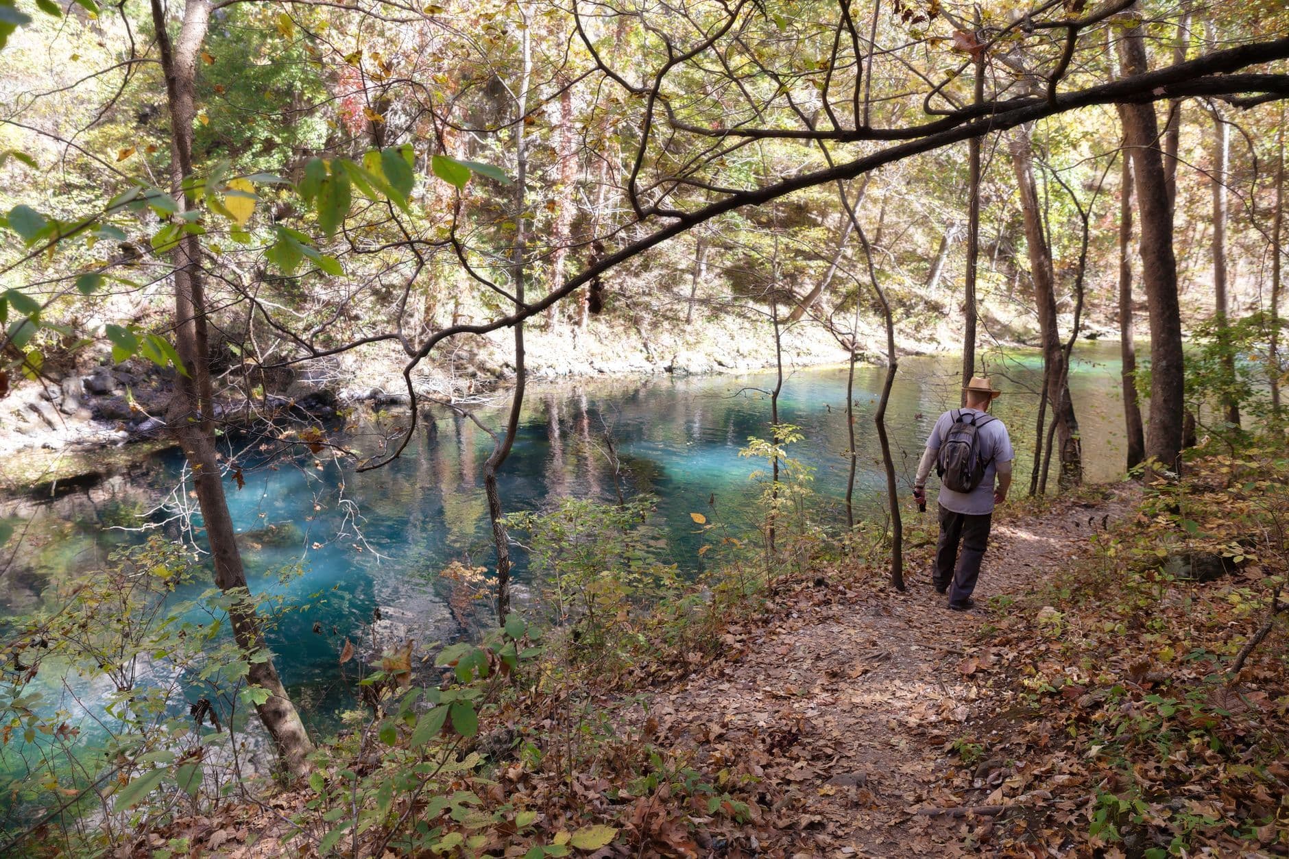
The trail unspools through oak and hickory shade before opening onto a limestone-walled swimming hole—cool, mineral-scented water perfect for wading solo without feeling isolated, since a handful of other early hikers usually share the pool. Bring a swimsuit under your clothes; the cascade midway through the route is worth the short scramble off-trail.

Lost Valley Trail
Photo by Deb Hayes on Pexels
The swimming hole with limestone bluffs reflected works best around 10am when sun angles into the valley.
Not wheelchair accessible; creek crossings require sturdy footing.
If it rains: If storms roll in, Blue Spring itself stays visually stunning in rain (the color deepens), but skip Lost Valley Trail's creek crossings until water recedes—wait it out with a slow coffee and let the trail dry before attempting it later in the day.

The day begins in near silence, with Blue Spring's impossible blue glowing under low morning light before anyone else arrives. This is the softest possible landing into the forest—no strenuous climbs, just still water and the sense of having found something rare before the rest of the world wakes up.

After the spring, the pace shifts only slightly onto Lost Valley Trail, where shaded woods give way to a limestone swimming hole. It's an easy, sociable stop—other solo hikers and small groups tend to linger here, making it a natural spot to strike up conversation about trail conditions or where to eat that night.

With no dining data available directly in this cluster, plan your evening meal in Van Buren or Salem depending on where you're staying; pack a light lunch for the trail itself and treat dinner as your first taste of small-town Ozark hospitality—diners here close early, so aim to arrive by 7:30pm.

River Immersion

Day 2: Adrift on the Eleven Point

A full water-focused day in the Eleven Point River Corridor covering minimal walking (under 2 miles) but several hours of paddling, moderate energy overall.

Wear
Swimwear under quick-dry layers, water shoes, a hat with a chin strap, sunscreen reapplied often, and a dry bag for phone/camera.
Budget
$70–100 (canoe/kayak rental, packed lunch, dinner in Van Buren)
45 min driveA quiet backroad drive south into the river corridor, forest thickening around you as cell bars disappear one by one.
7:30 AM - 10:30 AM
Eleven Point River · morning · 180 min · Eleven Point River Corridor

Launch early while the river is glassy and nearly empty—jade-green water slipping past sycamore-lined banks, the current gentle enough for a solo paddler to relax into rhythm rather than fight it. By late morning more boats appear, but this early window belongs almost entirely to birdsong and the soft dip of your own paddle.

Eleven Point River
Unknown / wikimedia (Public domain)
The Eleven Point access near Highway 160 offers sycamore-framed views best photographed in the low gold light just after sunrise.
No wheelchair access; entry points require walking over uneven riverbank terrain.
15 min driveA short hop between access points along the river road, gear rattling gently in the truck bed ahead of you.
12:00 PM - 4:00 PM
Current River Outfitters & Paddling Access Points · afternoon · 240 min · Eleven Point River Corridor

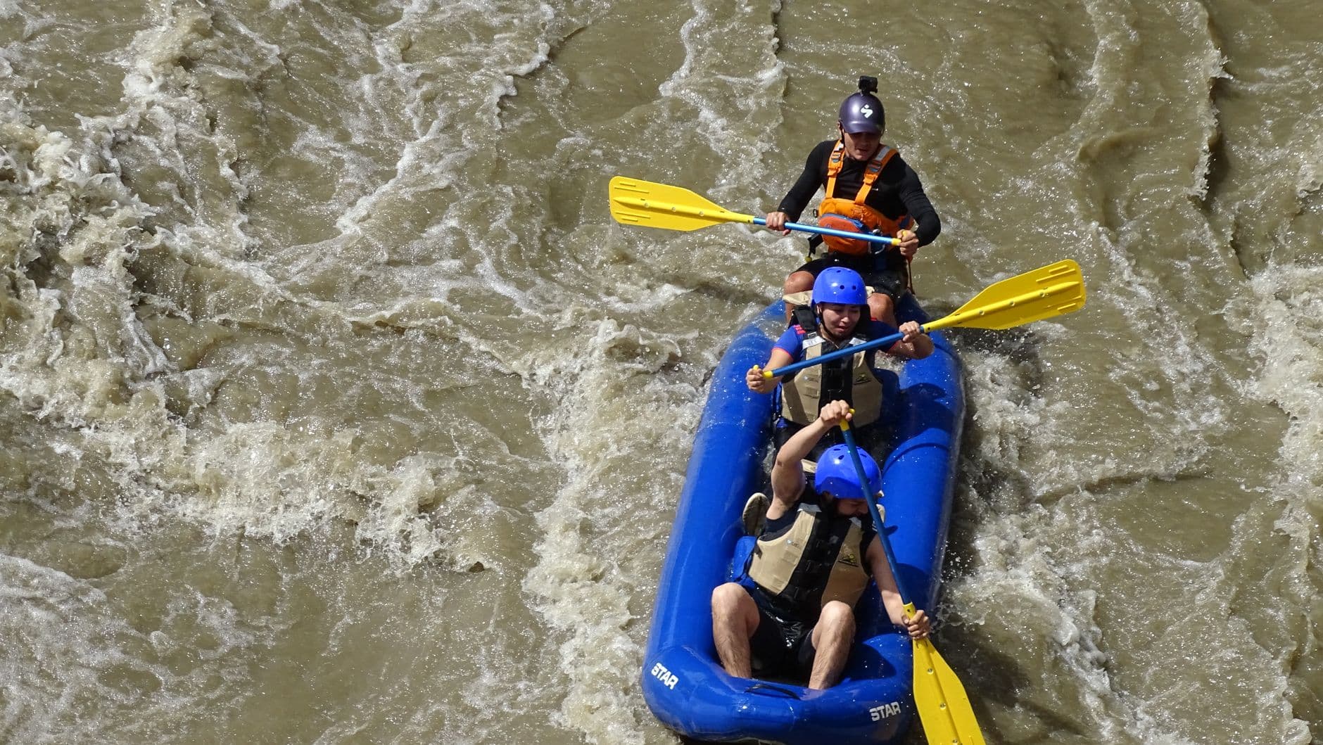
After a midday break to dry off and refuel, continue downstream through limestone canyons that rise 200 feet overhead—dramatic, cool-shadowed, and quiet enough mid-afternoon to feel like private wilderness. Outfitter staff and fellow paddlers make this a naturally social stretch of the day, easy for a solo traveler to fall into conversation with over shared river stories.

Current River Outfitters & Paddling Access Points
Photo by RAFTING CHICAMOCHA on Pexels
Bluff overhangs around mile 3–5 of the standard route are dramatic in early-afternoon light, and the sunset camp areas glow beautifully if you time your return for golden hour.
Limited accessibility; viewing-only options exist for those not paddling, but most access points involve uneven terrain.
Optional detour: Greer SpringAfter Current River Outfitters & Paddling Access Points and before ending the day
If energy allows, Greer Spring's dramatic 360-cubic-feet-per-second discharge makes a powerful, low-effort finale to a paddling day. Skip if: It's a longer drive south into a different cluster, and after a full water day most solo travelers will prefer rest over another moderate-energy stop.
If it rains: Heavy rain swells the river and makes paddling unsafe—if storms hit, postpone the float and instead treat the day as a scenic drive through the corridor with short walks at overlooks, saving the water activity for calmer conditions.

The river day starts before the heat does, gliding out onto still, mirror-flat water while the forest is at its most hushed. It's the kind of morning that rewards early risers doubly: fewer paddlers, softer light, and the rare sensation of total quiet on a river built for exactly that.

By midday the pace stays adventurous but social—outfitter stops and canyon paddling naturally put solo travelers alongside other groups, and the towering limestone walls make for a dramatic, energizing afternoon that never quite tips into exhausting.

As the sun drops toward the canyon rim, paddle back in for golden hour before heading into Van Buren for dinner—no specific dining data is mapped directly to this cluster, so plan your evening meal in town rather than at the river itself, and expect the local diners and cafes to wind down by 8 or 9pm.

Want to tweak this trip?

Our AI planner can customize this itinerary to your exact dates, interests, and travel style.

Customize This Itinerary
Good to Know

Restaurant details (hours, menus, availability) change frequently. Check current hours before visiting, especially in seasonal destinations.

Dietary compatibility tags are general guidance. If you have severe allergies, confirm directly with the restaurant.

Travel tips are general guidance, not professional safety advice. Check government advisories for latest information.

All prices are approximate and may vary seasonally.
We use cookies to improve your experience and analyze site usage. Essential cookies are always active. You can customize your preferences or accept all cookies. Cookie Policy