3 DaysSolo Traveler5 Stops

Bitterroot Valley (Hamilton, Darby), Montana

3-Day Itinerary for Solo Traveler

β€œPeaks, Water, and Wingbeats: Three Days Solo in the Bitterroot Valley”
Peaks, Water, and Wingbeats: Three Days Solo in the Bitterroot Valley

Between the Bitterroot and Sapphire ranges, the valley floor holds still while the peaks do all the talking. This is a trip built for solitude that doesn't feel lonely β€” quiet trailheads at dawn, wide skies, and small-town cafΓ©s where a stranger at the counter is just someone else's next conversation.

At a Glance

Climate & Weather
Summer in the valley runs warm and dry, peaking around 73Β°F, with clear mornings that can turn into sudden afternoon thunderstorms. Pack breathable layers, a sun hat, sunscreen, and a compact rain shell for surprise storms.
Getting Around
A car is essential β€” distances between clusters run 20-45 minutes and there's no public transit. Roads are well-paved on the valley floor but become winding and narrower heading into forest service roads; fill your gas tank in Hamilton before heading toward Darby or the high country.
Budget
Expect roughly $60-90 per day covering casual meals, coffee, and modest gear rental or trail snacks β€” this is not a fine-dining destination, and your money goes further at counter-service spots and diners.
Safety
This is bear and mountain lion country β€” carry bear spray on any forest or refuge trail and make noise on blind corners. As a solo traveler, tell someone your route and expected return time, especially before the Bitterroot NF day; cell coverage disappears fast once you're off US-93.
Connectivity
Cell service is reliable in Hamilton and along US-93 but drops out quickly in Bitterroot NF and patchy at Lee Metcalf Refuge. Download offline maps before you leave town each morning.
Local Tips
Trailheads in Bitterroot NF fill by mid-morning in July and August, so start before 8am if you want solitude; restaurants in Hamilton and Darby close early (9-10pm), so plan dinner accordingly rather than assuming late-night options.

Highlights

  • Sunrise stillness at Lake Como before the day-trippers arrive
  • A full day deep in Bitterroot National Forest's alpine wilderness
  • Golden-hour reflections on granite peaks mirrored in glacier-carved water
  • Sandhill cranes calling across the wetlands of Lee Metcalf Refuge
  • Hamilton's walkable main street for easy solo evenings
  • Genuine backcountry solitude without sacrificing comfort or safety

Day-by-Day Plan

Settling in, gentle orientation

Day 1: Arrival and the Quiet Mirror of Lake Como

A light first day easing into valley time with a walkable town stroll and a peaceful lakeside afternoon, roughly 2-3 miles of easy walking total.

Wear
Comfortable walking shoes, a light layer for cool morning air, sunscreen and a sun hat for midday, and a packable rain jacket just in case.
Budget
$50-70 including lunch, coffee, and dinner
1:30 PM - 3:00 PM
Lake Como Β· afternoon Β· 90 min Β· Hamilton Downtown & Lake Como

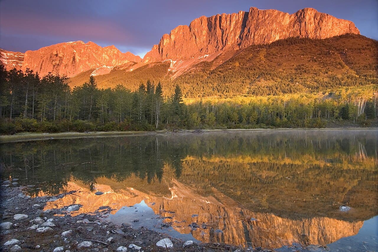
After settling into town, ease into the trip with the valley's gentlest introduction: still, blue-green water framed by granite peaks that seem to rise straight out of the shoreline. The flat, wheelchair-accessible path around the lake makes this an easy solo wander β€” no technical footing to think about, just the sound of water lapping and the occasional breeze moving through pine and sage. Arrive by mid-afternoon and you'll likely have long stretches of shoreline to yourself on a weekday.

Lake Como
Chuck Szmurlo (talkΒ Β· contribs) / wikimedia (CC BY 3.0)
Head to the north shore tree line for a reflection shot β€” the water is calmest and clearest in early-to-mid-afternoon light before wind picks up.
Flat, wheelchair-friendly path circles much of the lake, though benches are sparse β€” bring a foldable seat if you plan to linger.
If it rains: Light rain won't ruin Lake Como β€” the lake still photographs beautifully, though the mountain silhouettes lose some drama. If a real storm rolls in, cut the visit shorter and retreat to downtown Hamilton for coffee and to browse the galleries and shops along Main Street.

Use the morning to arrive unhurried β€” check into your lodging, walk a few blocks of Hamilton's historic main street to get your bearings, and let the quiet mountain-town rhythm set the pace for the days ahead. There's no agenda pressure here; this is the day to simply notice the light and the scale of the mountains framing the valley.

Drive the short distance out to Lake Como for a gentle, low-energy outing that rewards slow noticing over ambitious mileage. The granite peaks mirrored in the water make for an easy, meditative first outdoor stop, ideal for shaking off travel fatigue without overexerting on day one.

Head back into Hamilton as the light softens, and let the evening stay unstructured β€” a walk through downtown, an early dinner, and an early night to be well-rested for the bigger forest day ahead. Solo travelers will find the town's slower pace easy to settle into; nobody's rushing anywhere after dark here.

Alpine wilderness, high energy

Day 2: Into the High Country: A Full Day in Bitterroot National Forest

The trip's most physically demanding day, covering up to 5-6 miles of forest and alpine trail with significant elevation change and high solo-hiker reward.

Wear
Sturdy hiking boots, moisture-wicking layers, a warm mid-layer for higher elevations, rain shell, sun protection, and a hat β€” mountain weather shifts fast.
Budget
$40-60 including trail snacks, lunch, and dinner
45 min drive β€” Winding forest road south from Hamilton, pavement giving way to gravel, radio reception fading as the peaks close in around you
7:00 AM - 11:00 AM
Bitterroot NF Β· morning Β· 240 min Β· Bitterroot National Forest & High Country

This is the heart of the trip β€” 1.6 million acres of jagged peaks, lodgepole forest, and genuine remoteness. Arrive at the trailhead by 7am and you'll beat the crowds that fill parking areas by mid-morning in July and August; the early hours also mean cooler temperatures for the climb and softer light for photography. Carry bear spray, make noise on blind switchbacks, and let someone know your planned route β€” this is real backcountry, and the solitude that makes it special is also why basic precautions matter.

Bitterroot NF
Host, John R Schlieter, Joyce A Forestry Sciences Laboratory (Missoula, Mont.) 1n / wikimedia (Public domain)
If you're pushing toward Trapper Peak, the summit views across the Main Bitterroot divide are best in the soft morning light before haze builds later in the day.
Trails here are unpaved and uneven with real elevation gain β€” not accessible for mobility-limited visitors; those wanting a lower-impact version should stick to scenic pullouts and riverside flats.
15 min walk β€” A short walk back toward the trailhead area for lunch before continuing on a different, gentler stretch of forest
12:30 PM - 3:30 PM
Bitterroot NF Β· afternoon Β· 180 min Β· Bitterroot National Forest & High Country

After a trailside lunch break, continue exploring the forest at a gentler pace β€” a shorter loop trail, a scenic overlook, or simply following a creek downstream. The rush of water over stone and wind moving through pine canopy make solo hiking here feel restorative rather than isolating; other hikers on popular routes offer easy nods and trail-chat if you're craving conversation.

Bitterroot NF
Host, John R Schlieter, Joyce A Forestry Sciences Laboratory (Missoula, Mont.) 1n / wikimedia (Public domain)
If conditions allow reaching Mirror Lake later in summer, the still water throws back near-perfect reflections of the surrounding granite in early afternoon light.
Choose lower-elevation, flatter forest trails for an easier afternoon if the morning's climb was taxing.
Optional detour: Skalkaho Pass scenic drive β€” After the morning hike and before the afternoon forest walk
A scenic driving loop offers a lower-energy way to see more of the high country if your legs need a break from hiking. Skip if: Skip it if you're maximizing trail time or if weather is closing in on higher elevations, since the pass can turn dangerous quickly in storms.
If it rains: Light rain keeps lower-elevation forest trails passable, but higher alpine routes become genuinely dangerous with lightning risk β€” if storms roll in, retreat to the scenic driving loop via Skalkaho Pass or head back to Hamilton to spend the afternoon at the town's museums instead.

Start early β€” ideally on the road by 6:30am so you're at the trailhead as the sun clears the ridgeline. The forest wakes up slowly: mist lifting off creek beds, the first birdsong, cool air that still carries the previous night's chill. This is prime solo-hiking territory, with enough popular trail traffic for safety and camaraderie but plenty of room to walk in silence when you want it.

After refueling with a packed lunch trailside, shift into a gentler gear for the afternoon β€” a shorter loop or scenic pullout rather than another summit push. The pace shift matters: yesterday's low-key lake outing and this morning's strenuous climb make an easier afternoon the right call before tomorrow's wetlands day.

The drive back to Hamilton as evening light rakes across the peaks is one of the day's quiet highlights β€” pull over if a viewpoint catches you off guard. Back in town, an early dinner and a good night's sleep are earned; tomorrow trades elevation for wetlands and wildlife.

Wildlife and quiet farewell

Day 3: Wetlands, Wingbeats, and the Valley Floor

A moderate-energy final day exploring the wetlands south toward Darby, with roughly 2-3 miles of easy trail walking and abundant birdwatching.

Wear
Waterproof boots or trail shoes, a light jacket for cool morning air, binoculars if you have them, and sun protection for midday.
Budget
$40-55 including breakfast, lunch, and departure-day incidentals
40 min drive β€” South on US-93 toward Darby, the valley floor widening and the mountains pulling back to reveal open ranchland and river bends
7:30 AM - 9:30 AM
Lee Metcalf NWR Β· morning Β· 120 min Β· Lee Metcalf Refuge & South Valley

Arrive early and the refuge feels like the valley exhaling β€” sandhill cranes calling across the wetlands, cattails rustling, mist still clinging to the water before the sun burns it off. Weekday mornings here are especially quiet, making this an ideal solo stop for unhurried wildlife photography and the kind of stillness that's hard to find elsewhere. The auto tour route and viewing platforms mean you can go as far or as little as you like.

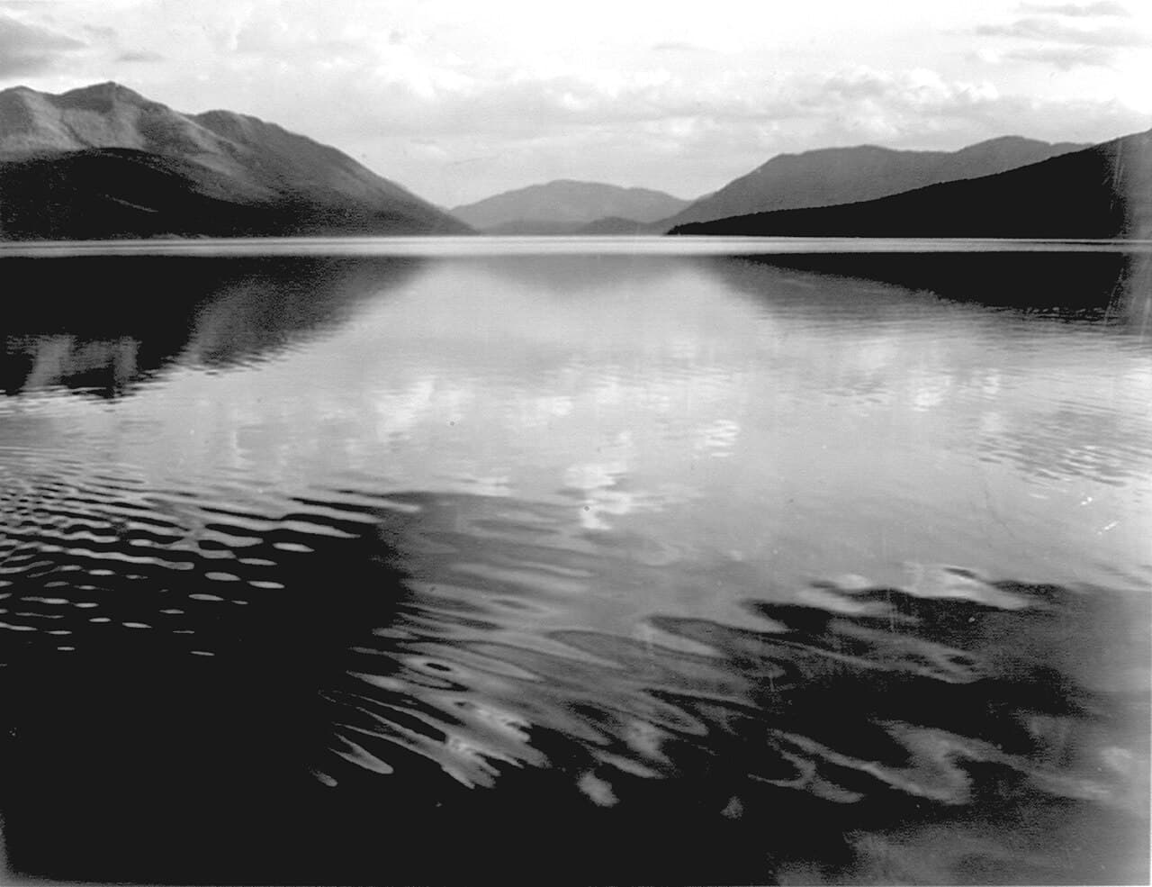
Lee Metcalf NWR
U.S. National Park Service, restoration/cleanup by National Park Maps (https://npmaps.com) / wikimedia (Public domain)
The auto tour viewing platforms overlooking the main wetland pools are best just after sunrise, when light is soft and birds are most active.
Trails are unpaved and can be muddy, especially after rain; the auto tour route offers a more accessible way to see the wetlands without walking uneven ground.
10 min walk β€” A short walk from the main viewing platforms toward the ridge trailhead, gravel crunching underfoot
9:30 AM - 11:00 AM
Lee Metcalf NWR Β· midday Β· 90 min Β· Lee Metcalf Refuge & South Valley

Extend the visit toward the ridge trail for wider valley views, mountains framing the wetlands in a way that feels almost staged. This is a good stretch to slow down further β€” fewer visitors here than at the main platforms, and the quiet makes it easy to spot movement in the reeds you'd otherwise miss.

Lee Metcalf NWR
U.S. National Park Service, restoration/cleanup by National Park Maps (https://npmaps.com) / wikimedia (Public domain)
Ridge trail vistas work well mid-morning once the mist has cleared but before the light turns flat around noon.
The ridge trail has uneven, sometimes muddy footing β€” those needing flatter terrain should stay near the auto tour and main platforms.
Optional detour: Bitterroot River overlook near refuge entrance β€” Before entering the main refuge trails
A quick, easy stop for river views and a chance to spot wildlife along the water before heading into the wetlands proper. Skip if: Skip if you're short on time or eager to reach the main viewing platforms before the morning light window closes.
If it rains: The refuge stays accessible in rain and wildlife viewing can actually improve as animals grow more active under overcast skies β€” just bring waterproof boots and rain gear, and expect muddier trail conditions than a dry morning.

Get an early start south toward Darby while the valley is still cool and hushed. The refuge in early light is the trip's most contemplative stop β€” no crowds, no rush, just cranes overhead and mountains standing quiet guard around the wetlands.

Wind down the trip with a relaxed midday at the ridge trail's wider views before starting the drive back north, giving yourself time to stop wherever the light or the mood calls for it. This lighter final stretch mirrors day one's pace, bookending the trip with calm after the forest day's intensity.

Depending on departure timing, use the late afternoon for a final unhurried walk through Hamilton or a last look at the valley from wherever feels right β€” there's no need to rush the goodbye. This is a place that rewards lingering, and the quiet drive out along US-93 makes a fitting close to three days of solo mountain time.

Want to tweak this trip?

Our AI planner can customize this itinerary to your exact dates, interests, and travel style.

Customize This Itinerary
Good to Know

Restaurant details (hours, menus, availability) change frequently. Check current hours before visiting, especially in seasonal destinations.

Dietary compatibility tags are general guidance. If you have severe allergies, confirm directly with the restaurant.

Travel tips are general guidance, not professional safety advice. Check government advisories for latest information.

All prices are approximate and may vary seasonally.
We use cookies to improve your experience and analyze site usage. Essential cookies are always active. You can customize your preferences or accept all cookies. Cookie Policy