2 DaysCouples6 Stops

Great Smoky Mountains (NC side), North Carolina

2-Day Itinerary for Couples

Mist, Elk, and Ridgelines: Two Days in the Smokies

Mist, Elk, and Ridgelines: Two Days in the Smokies

Mist pools in the valleys here like something poured rather than formed, and wild elk graze through it as if the twentieth century never arrived. This is the quieter side of the Smokies—where two days spent moving slow between elk meadows, waterfall trails, and cloud-wrapped summits will feel like far more than forty-eight hours.

At a Glance

Climate & Weather
Spring in the NC Smokies means mild days, chilly mornings, and rain that can arrive without much warning—pack a waterproof shell, layers you can shed by midday, and sturdy waterproof footwear. Higher elevations like Clingmans Dome run 10-20 degrees cooler than the valley floor, so bring a warm layer even if the base of the mountain feels balmy.
Getting Around
A personal vehicle is essential; there's no public transit into or within the park. Roads are narrow and winding with frequent pull-offs—budget extra time for scenic drives and expect slower going after rain.
Budget
Expect roughly $90-140 per day for two people, covering meals, gas, and incidentals—the park itself has no entrance fee, so most spend goes toward dining and one splurge dinner.
Safety
This is a low-risk destination for couples, but respect wildlife distances—especially elk during spring calving season—and stay on marked trails, which can be slick with spring rain. Cell service is unreliable throughout the park, so let someone know your general plans for the day.
Connectivity
Cell coverage is spotty to nonexistent inside the park, improving in Cherokee and Waynesville. Download offline maps before you go and treat this as a genuine digital pause.
Local Tips
Arrive at trailheads and overlooks before 8am in spring shoulder season to have them nearly to yourselves; wildflowers peak along lower elevation trails this time of year, so keep an eye on the trail edges as much as the views ahead; many mountain restaurants close by 8pm and some shutter entirely on Mondays, so plan dinner reservations accordingly.

Highlights

  • Dawn elk-watching in Cataloochee's mist-veiled meadows
  • Standing above the clouds at Clingmans Dome, the AT's highest point
  • A hemlock-shaded pilgrimage to Laurel Falls
  • 31 miles of ridge-line drama along Newfound Gap Road
  • The rhythmic thunder of a 140-year-old working grist mill
  • Cherokee heritage at the Oconaluftee river valley

Day-by-Day Plan

arrival, wildlife, wonder

Day 1: Valley of the Elk

A gentle first day centered on Cataloochee Valley's wild elk herds and pastoral quiet, with under 2 miles of easy walking.

Wear
Waterproof jacket, layers, sturdy walking shoes, and a warm hat for cool valley mornings.
Budget
$70-100 for two, including gas and a casual dinner
7:30 AM - 9:30 AM
Cataloochee Valley (elk) · morning · 120 min · Cataloochee Valley

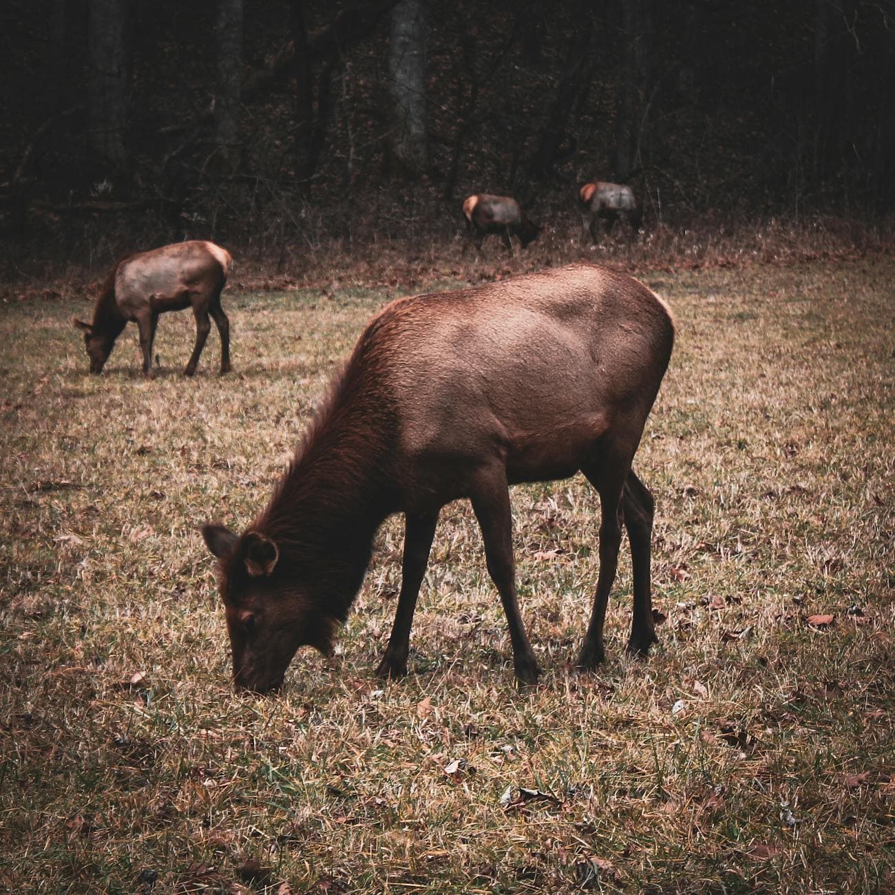
Arrive while the valley still holds its overnight mist, and you'll likely have the meadows to yourselves save for the elk. Watch tawny shapes move through knee-high grass as a bull's distant bugle echoes off the ridgelines—this is the kind of quiet, unhurried wonder that sets the tone for a couple's trip. Bring binoculars if you have them, and speak softly; sound carries far in this hollow.

Cataloochee Valley (elk)
Niki Clark / pexels (Pexels License)
The Caton Cove Road pull-off, where the valley widens, offers the best chance to frame elk against open meadow in soft morning light.
Terrain is unpaved and uneven in spots; roadside viewing from pull-offs is easiest for those who prefer not to walk far.
10 min walkA short stroll along the valley loop road, damp grass brushing your ankles
9:30 AM - 10:30 AM
Cataloochee Valley (elk) · midday · 60 min · Cataloochee Valley

Extend the morning with a slow walk toward Palmer Chapel and the historic homesteads scattered through the valley—weathered wood structures that speak to the families who once called this isolated hollow home. It's a quiet, contemplative counterpoint to the wildlife-watching, ideal for a couple who wants both awe and history in the same morning.

Cataloochee Valley (elk)
Niki Clark / pexels (Pexels License)
Palmer Chapel's white clapboard exterior glows nicely in late-morning light against the green valley backdrop.
Flat gravel path near the chapel, but ground can be muddy after spring rain.
Dinner
Peter's Pancakes & Waffles $
Breakfast/Brunch · Near Oconaluftee, roughly 45 minutes from Cataloochee
A cozy, unpretentious spot near Oconaluftee worth the drive back toward town for a comfort-food dinner after a long valley day.
Optional detour: Mingus MillAfter Cataloochee Valley and before dinner
The rhythmic thunder of the working water wheel makes a soothing, low-key stop if you're driving back through Oconaluftee anyway. Skip if: It's a 45-minute drive from Cataloochee and better saved for Day 2's Oconaluftee morning if time feels tight.
If it rains: If heavy rain rolls in, elk viewing becomes difficult—shift focus to the historic homesteads (Palmer Chapel, Abrams House), which remain atmospheric and moody under mist, or head toward Cherokee for indoor cultural stops.

The valley wakes slowly, mist clinging to the grass long after sunrise, and elk move through it like ghosts of an older Appalachia. Arriving by 7:30am rewards you with near-total solitude—by mid-morning, other cars begin trickling in, but for now it's just the two of you, the elk, and the sound of dew dropping from rhododendron leaves.

After the elk-watching settles into something quieter, the pace shifts toward the valley's human history—weathered homesteads and the small white chapel that anchored this community for generations. It's a gentle, reflective afternoon, the kind that asks nothing more than slow walking and quiet conversation.

As afternoon fades, the drive back toward Oconaluftee unwinds through darkening ridgelines, headlights catching mist rising off the creek beds. Dinner at Peter's Pancakes & Waffles offers unfussy comfort food to close a day built on stillness rather than spectacle—an easy, low-key end to a first day that asked you to simply notice.

summit views, waterfall, heritage

Day 2: Above the Clouds, Beneath the Falls

A fuller day combining Clingmans Dome's summit drama with the ridge-line beauty of Newfound Gap Road and a waterfall hike, totaling roughly 3-4 miles of walking.

Wear
Warm layers for the summit (temperatures can be 15-20 degrees cooler), a rain shell, and broken-in hiking shoes with good tread for the Laurel Falls trail.
Budget
$80-120 for two, including a splurge dinner
7:00 AM - 8:30 AM
Clingmans Dome · morning · 90 min · Clingmans Dome High Country

Arrive at first light and climb into air that smells sharply of fraser fir, your ears popping as you gain elevation until you emerge above a layer of cloud into blinding, quiet sunlight. By 7am the observation tower is nearly empty—an intimate, almost private moment atop the highest point on the Appalachian Trail, made for two people who want awe without a crowd. By 9am, the parking lot fills and the tower gets shoulder-to-shoulder.

Clingmans Dome
Famartin / openverse (by-sa)
The tower's exterior platform at sunrise, with the forest below silhouetted against rising light, is the shot worth setting an alarm for.
The paved path to the tower is steep in sections; wheelchair accessible but requires effort and isn't flat.
15 min driveA winding descent from the Dome parking area, fir trees giving way gradually to hardwoods
9:00 AM - 11:00 AM
Newfound Gap Road · midday · 120 min · Clingmans Dome High Country

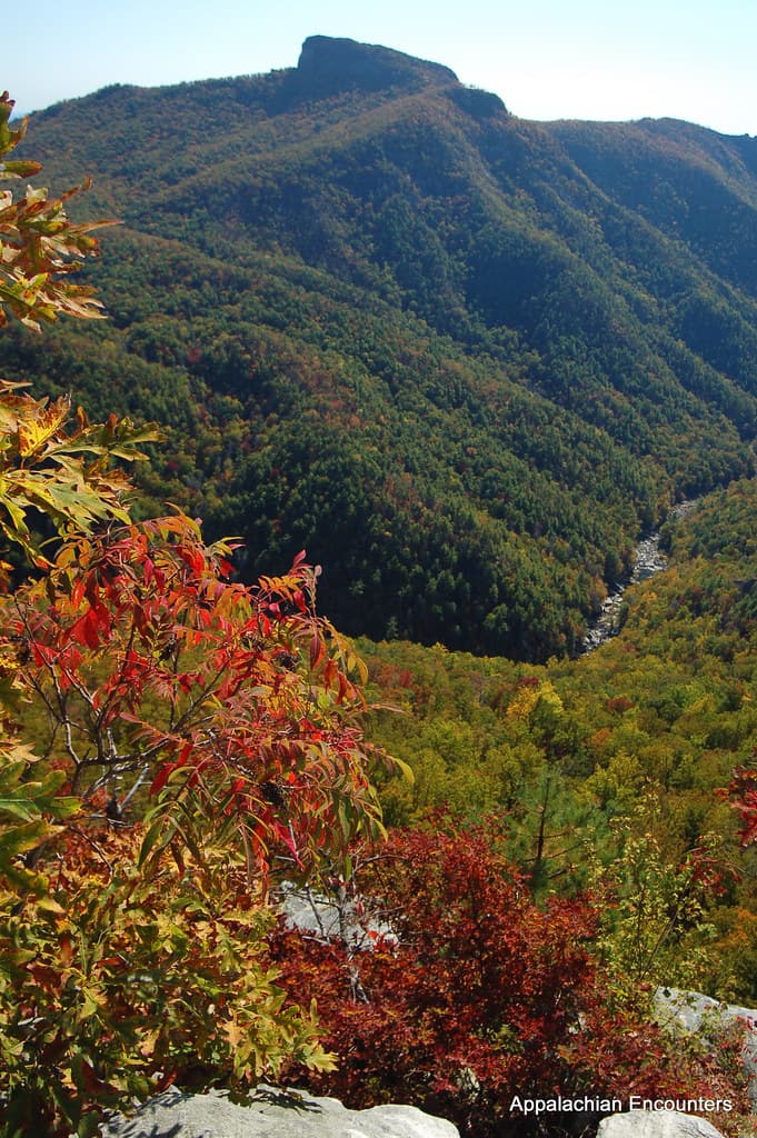
Descend slowly, windows down, as 31 miles of ridge-line curves unfold layer after layer of blue-hazed mountains. Stop at the Newfound Gap overlook, straddling the Tennessee-North Carolina line, where spring wildflowers dot the roadside and the view stretches for what feels like the whole of Appalachia. This is a drive best taken unhurried, with no destination pressure—just curve after curve of quiet drama.

Newfound Gap Road
Photo by Esteban Carriazo on Pexels
The Newfound Gap overlook is best photographed mid-morning once any lingering fog has lifted but before midday haze sets in.
Overlooks along the road are paved and accessible with minimal walking required.
35 min driveA scenic descent back toward Oconaluftee, rhododendron thickening along the roadside as elevation drops
1:00 PM - 2:30 PM
Laurel Falls Trail · afternoon · 90 min · Oconaluftee Gateway

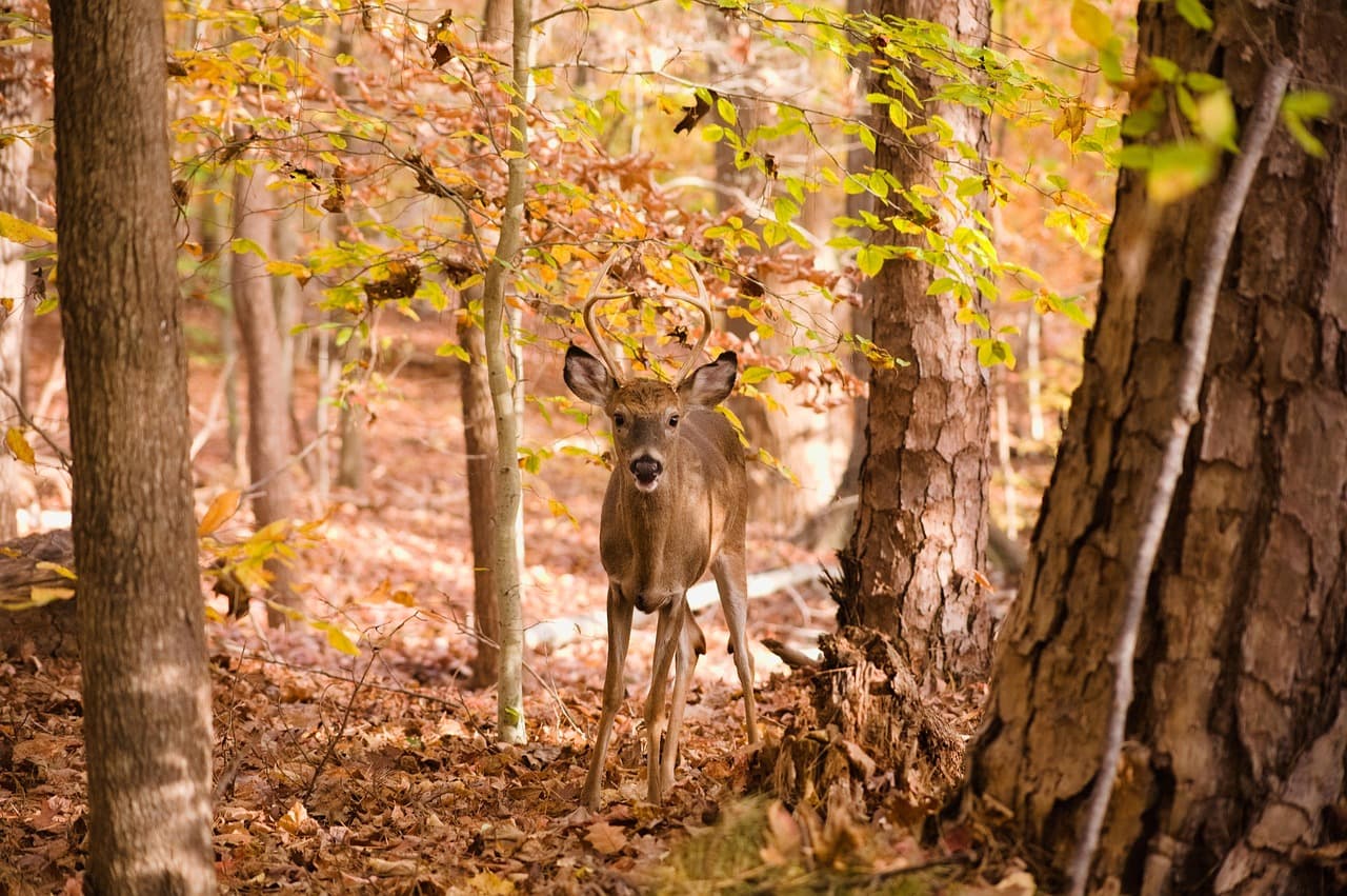
The trail rises gently through old hemlocks, the roar of falling water building steadily until the falls reveal themselves in a sudden rush of white against green. Spring rains have the falls running full and loud—a fitting, romantic reward after a morning of quieter contemplation at the summit. Arrive after 1pm and the crowds from the morning rush will have thinned considerably.
Laurel Falls Trail
Photo by jothamsutharson on Pixabay
Frame the base of the falls with hemlock branches for scale—midday light filters through the canopy nicely by early afternoon.
Trail is paved but steep and uneven in places; not recommended for those with mobility limitations.
Lunch
Hunt Brothers Pizza $
Pizza · Near Oconaluftee
A quick, no-frills option near Oconaluftee if you want something fast between the drive and the trail.
Dinner
El Cajelito $$
Mexican · Near Oconaluftee
A warm, flavorful contrast to the day's mountain fare—worth the stop for a relaxed, unfussy dinner near Oconaluftee to close the trip.
Optional detour: Mingus MillAfter Laurel Falls Trail and before dinner
The hypnotic rhythm of the 140-year-old water wheel and the smell of freshly ground corn make a peaceful, low-energy close to an active day. Skip if: If you're tired from the falls hike or running short on daylight, it's easy to skip without losing the day's core experience.
Optional detour: OconalufteeBefore Mingus Mill or before dinner
A short stop at the river overlook offers a quiet, reflective moment with mist rising off the water and mountains framing the valley. Skip if: Skip if you're pressed for time getting to dinner reservations before the 8pm mountain-town closing rhythm.
If it rains: If rain moves in over the summit or falls, retreat to lower elevations near Newfound Gap for alternative scenic views, or shift the Laurel Falls hike to Mingus Mill and the Oconaluftee river overlook, both of which remain atmospheric—even enhanced—in misty conditions.

Cold, clear air greets you at nearly 6,600 feet, the fraser firs releasing their scent as you climb toward the tower ahead of the day's crowds. Above the cloud layer, the world narrows to just the two of you and an endless, silent view—the kind of shared quiet that anchors a trip's best memory.

The pace eases into a long, scenic drive down Newfound Gap Road, curve after curve revealing new blue-ridged vistas, before the day sharpens again with the climb toward Laurel Falls. The transition from summit stillness to waterfall roar marks a satisfying shift in energy, hemlocks closing in cool and green around the trail.

As afternoon light softens, wind down with dinner at El Cajelito, a warm and unhurried close to two days spent moving between mist, elk, and ridgelines. Mountain towns quiet early, so settle in—there's no rush left in the evening, only the quiet satisfaction of having seen the Smokies slowly, together.

Want to tweak this trip?

Our AI planner can customize this itinerary to your exact dates, interests, and travel style.

Customize This Itinerary
Good to Know

Restaurant details (hours, menus, availability) change frequently. Check current hours before visiting, especially in seasonal destinations.

Dietary compatibility tags are general guidance. If you have severe allergies, confirm directly with the restaurant.

Travel tips are general guidance, not professional safety advice. Check government advisories for latest information.

All prices are approximate and may vary seasonally.

We use cookies to improve your experience and analyze site usage. Essential cookies are always active. You can customize your preferences or accept all cookies. Cookie Policy