2 DaysCouples6 Stops

Great Smoky Mountains (NC side), North Carolina

2-Day Itinerary for Couples

ā€œElk Meadows & Sky-High Ridgelines: Two Days in the Smokiesā€

Elk Meadows & Sky-High Ridgelines: Two Days in the Smokies

Mist pools in the hollows here before sunrise, and wild elk graze like they own the valley — because in a way, they always have. This is the quieter, wilder half of the Smokies, where two days move at the pace of a mountain stream: slow, deliberate, and full of small astonishments.

At a Glance

Climate & Weather
Summer brings warm, humid days in the valleys (upper 70s–80s°F) but noticeably cooler air at elevation — Clingmans Dome can feel 15-20 degrees cooler with brisk wind. Afternoon thunderstorms are common, so pack a light rain shell, layers for the summit, and sturdy walking shoes.
Getting Around
A personal vehicle is essential — no public transit serves the park. Distances between clusters can take 45-75 minutes on winding mountain roads, so budget extra time and treat the drives themselves as part of the experience.
Budget
Plan roughly $90-140/day per couple for meals and modest incidentals — the park itself has no entrance fee, though parking tags are required at high-use areas.
Safety
Very safe for couples exploring together, but keep a respectful distance from elk (100+ feet) and never approach — bulls can be unpredictable during summer. Stay on marked trails, especially near waterfalls where rocks are slick, and carry water even on short walks.
Connectivity
Cell service is spotty to nonexistent inside the park, especially in Cataloochee's remote valley and along Clingmans Dome Road. Download offline maps beforehand and let someone know your general plans if venturing onto trails.
Local Tips
Arrive at Cataloochee by dawn — elk are most active and visible in the first hour of light, and the gravel road in feels wonderfully remote. Book any dinner reservations in Waynesville or Cherokee ahead, as summer weekends fill fast, and note many mountain restaurants close by 8 PM.

Highlights

  • Dawn elk-watching in Cataloochee's mist-veiled meadows
  • Sunrise summit views atop Clingmans Dome, the highest point on the AT
  • 31 miles of ridge-line drama along Newfound Gap Road
  • A hemlock-shaded pilgrimage to Laurel Falls
  • Cherokee heritage and history at Oconaluftee
  • Golden hour at Mingus Mill's 140-year-old water wheel

Day-by-Day Plan

Arrival & Wildlife

Day 1: Valley of the Elk, Threshold of the Cherokee

A gentle first day covering roughly 2.5 miles of easy walking, centered on dawn wildlife viewing and a soft introduction to Cherokee heritage and river valleys.

Wear
Layered breathable clothing, closed-toe walking shoes, a light jacket for cool morning air, and a hat for midday sun.
Budget
$95-120 for two, including breakfast, lunch, and a mid-range dinner
6:30 AM - 8:30 AM
Cataloochee Valley (elk) Ā· morning Ā· 120 min Ā· Cataloochee Valley

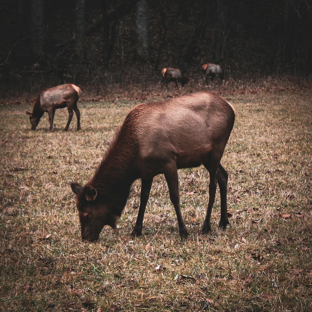
Arrive while the valley still holds its night chill and you'll likely have the meadows to yourselves — elk are most active in this first hour, their breath visible in the cool air as they graze through knee-high grass. The drive in on the gravel road feels like slipping back a century; pull off at Caton Cove Road where the valley widens and small herds often congregate. By 9 AM, the light turns harsh and the crowds arrive, so this early window is a gift, especially for a couple wanting quiet, unhurried wonder.

Cataloochee Valley (elk)
Niki Clark / pexels (Pexels License)
Shoot from Elk Pen Gap overlook just after sunrise, when low-angle light rims the elk in gold and mist still clings to the grass.
Uneven, unpaved terrain in places; sturdy shoes recommended, and benches are sparse.
75 min drive — A long but scenic haul south — winding two-lane roads through deep forest, worth a coffee thermos and easy conversation.
11:00 AM - 11:45 AM
Oconaluftee Ā· midday Ā· 45 min Ā· Oconaluftee Gateway

The valley opens here into something softer — a river threading past ancestral Cherokee lands, with mist still rising off the water even at midday. Pause at the main overlook where the Oconaluftee River frames distant ridgelines; it's a gentle, contemplative stop after the early wildlife excitement, easy walking and wheelchair accessible for a slower-paced midday breather.

Oconaluftee
James St. John / openverse (by)
The US 441 bridge crossing offers a classic shot of mist and river with mountain backdrop — best in soft midday light when fog hasn't fully burned off.
Flat, paved paths and wheelchair accessible throughout.
10 min walk — An easy flat path through the woods, cool and shaded even in summer heat.
1:00 PM - 1:45 PM
Mingus Mill Ā· afternoon Ā· 45 min Ā· Oconaluftee Gateway

A short stroll from Oconaluftee brings you to a working water-powered mill where the rumble of turning stones and the acrid dust of fresh-ground corn transport you 140 years back. It's low-energy and intimate — a nice hand-in-hand wander through timber-frame history, with frequent benches for lingering.

Mingus Mill
Photo by Jteder on Pixabay
Interior shots of the grinding stones catch beautiful soft window light in early afternoon.
Wheelchair accessible with flat paths and frequent benches.
Breakfast
Peter's Pancakes & Waffles $
Breakfast/Brunch Ā· Near Oconaluftee
A cozy, no-fuss stop for stacked pancakes and strong coffee before the early elk-watching drive — worth arriving before the post-hike crowd.
Lunch
Happy Garden Restaurant $
Chinese Ā· Near Oconaluftee
A quick, satisfying option near Oconaluftee if you want something different from mountain comfort food after a morning outdoors.
El Cajelito $
Mexican Ā· Near Oconaluftee
Casual and flavorful, a good midday refuel spot close to the visitor center.
Dinner
Hunt Brothers Pizza $
Pizza Ā· Near Oconaluftee
Simple, low-key pizza near Oconaluftee — a relaxed, no-reservation way to end a slow first day.
If it rains: If rain moves in, elk viewing is still possible with mist adding drama — heavy downpours make the historic homesteads near Palmer Chapel a cozier, drier alternative, or retreat toward Oconaluftee's covered mill viewing areas.

The first light finds you on a gravel road deep in Cataloochee, windows down, the air thick with damp earth and rhododendron. Wild elk move through the mist like ghosts of an older world, and for this quiet hour before the day-trippers arrive, the valley belongs entirely to you two.

The pace softens as you drive south toward Oconaluftee, trading wild grasslands for the gentle hush of a river valley steeped in Cherokee heritage. A short walk to Mingus Mill rounds out the afternoon with the hypnotic turn of century-old millstones and the cool spray of the millrace.

Dinner stays simple and unhurried near Oconaluftee — this is a day for settling into mountain rhythm, not chasing reservations. Let the evening wind down early; tomorrow's summit sunrise calls for rest.

Summit & Cascade

Day 2: Above the Clouds: Ridgeline and Waterfall

A moderately active day covering roughly 3.5 miles of walking across high-elevation overlooks and a waterfall trail, with more physical exertion than Day 1.

Wear
Warm layers for summit wind chill, a waterproof shell, sturdy hiking shoes with grip for the waterfall trail, and sunglasses for bright ridge-line light.
Budget
$100-135 for two, including breakfast, lunch, and a splurge dinner in Waynesville
7:00 AM - 9:00 AM
Newfound Gap Road Ā· morning Ā· 120 min Ā· Clingmans Dome High Country

Set out early and the road feels like it belongs only to the two of you — 31 miles of switchbacks revealing layered blue ridges through a windshield still fogged with morning cool. Stop at the Newfound Gap overlook where North Carolina meets Tennessee at the state line; the air smells of Fraser fir, and by 9 AM the pull-offs start filling with day-trippers escaping the summer heat below.

Newfound Gap Road
Photo by Esteban Carriazo on Pexels
The Newfound Gap overlook at the state line is best photographed in the soft, low light of early morning before haze builds.
Overlooks are wheelchair accessible; trail spurs are not.
20 min drive — A short, curvy ascent — the temperature noticeably drops as you climb, a small thrill in itself.
9:30 AM - 11:00 AM
Clingmans Dome Ā· midday Ā· 90 min Ā· Clingmans Dome High Country

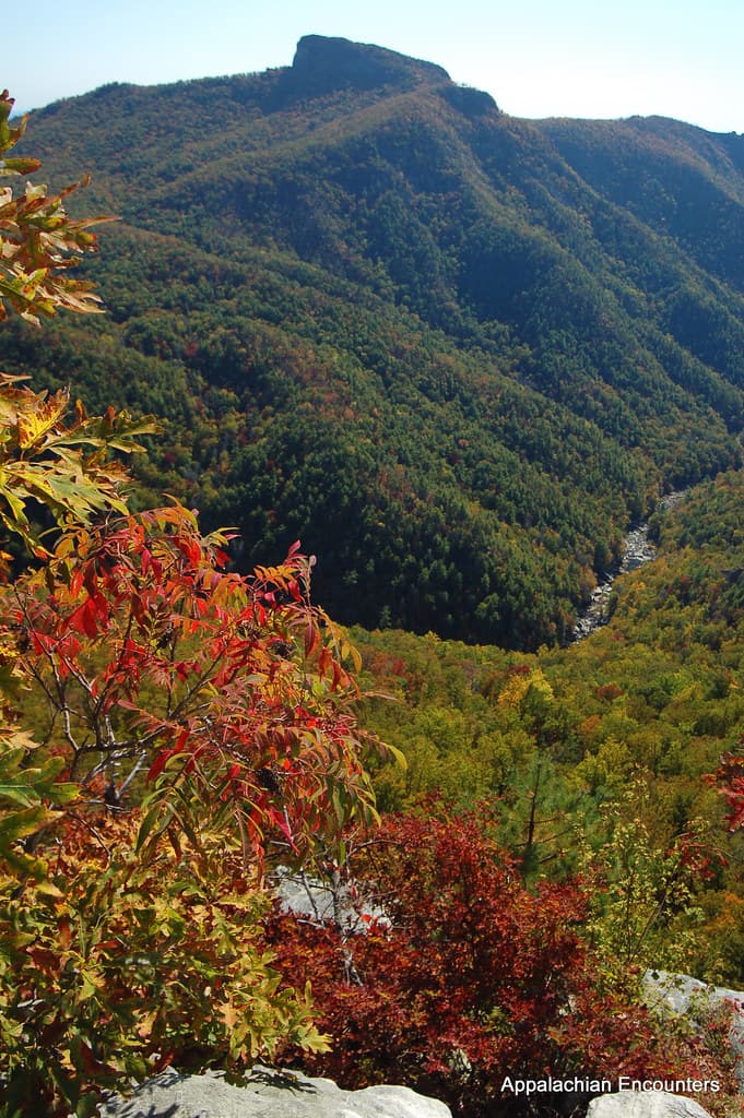
The climb to the observation tower leaves your lungs pleasantly burning and your ears popping from the elevation — then the view breaks open above the cloud layer, the highest point on the entire Appalachian Trail spread beneath you. This is the trip's splurge moment, not in dollars but in effort and awe; arrive by mid-morning and you'll beat the thickest crowds while still catching clear skies before afternoon haze rolls in.

Clingmans Dome
Famartin / openverse (by-sa)
Shoot from the tower's exterior platform; midday light is workable here since elevation keeps colors crisp, but sunrise or late afternoon light adds drama through the glass panels.
Paved but steep path to the tower; wheelchair accessible with effort, benches sparse.
45 min drive — A descent back toward familiar valley roads, windows cracked to let in the warming afternoon air.
2:00 PM - 3:30 PM
Laurel Falls Trail Ā· afternoon Ā· 90 min Ā· Oconaluftee Gateway

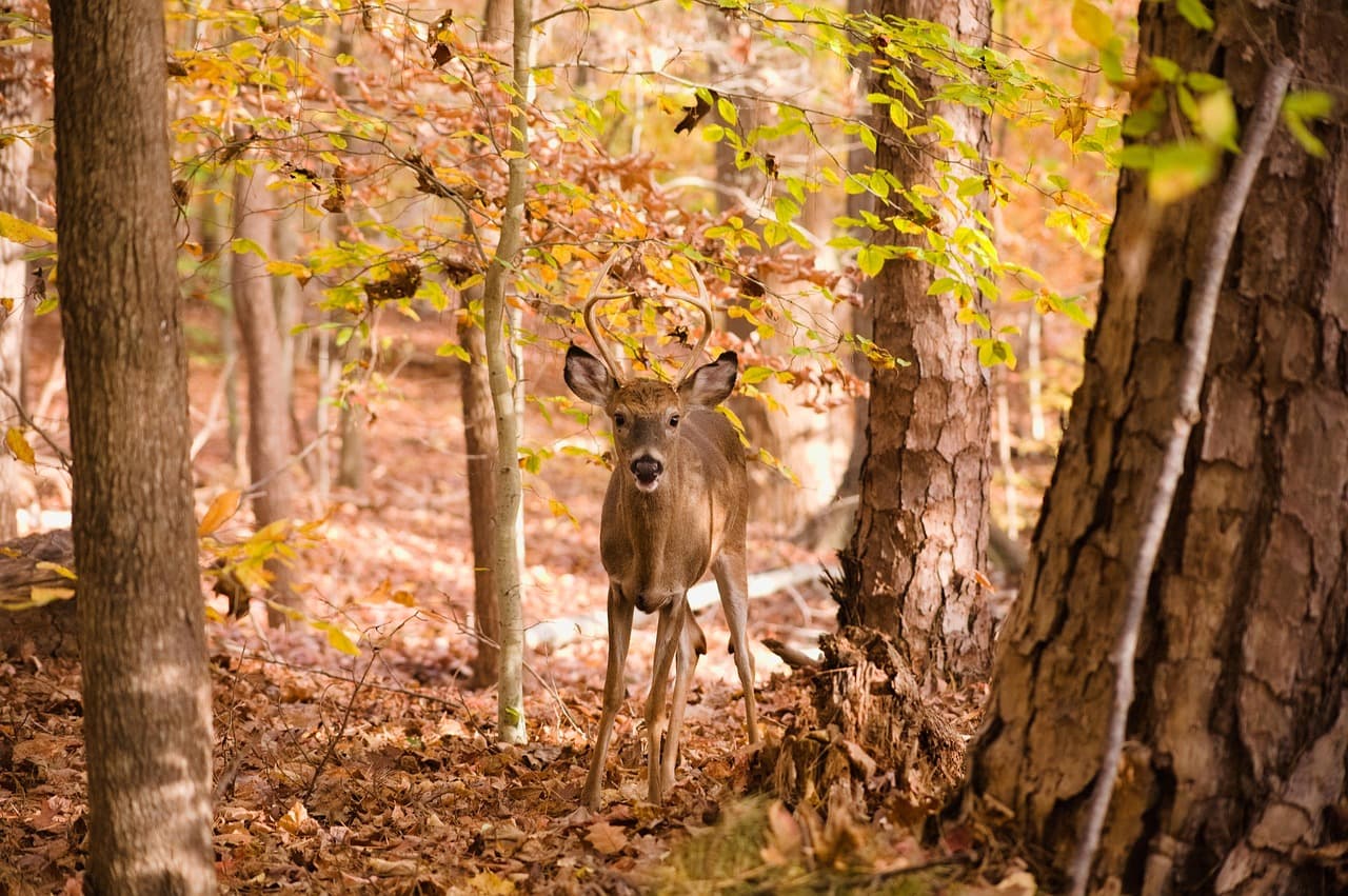
The trail unwinds beneath towering old-growth hemlocks, moss soft underfoot, the roar of falling water growing steadily louder until the falls reveal themselves in a hemlock-framed curtain of white. It's an ideal romantic afternoon walk for couples — moderate but manageable, with a payoff that feels earned rather than epic, perfect after the morning's higher-elevation exertion.
Laurel Falls Trail
Photo by jothamsutharson on Pixabay
The base of the falls, framed by hemlocks, photographs best in dappled early-to-mid-afternoon light.
Uneven, sometimes slick terrain; not accessible for wheelchairs, sparse benches along the way.
Breakfast
Peter's Pancakes & Waffles $
Breakfast/Brunch Ā· Near Oconaluftee
A hearty, unfussy start before the early drive up Newfound Gap Road — fuel up before the elevation climb.
Lunch
El Cajelito $
Mexican Ā· Near Oconaluftee
A relaxed, flavorful midday stop on the way back down from the high country, easy to fit between summit and trail.
Dinner
Happy Garden Restaurant $
Chinese Ā· Near Oconaluftee
A comforting, low-key close to an active day if you'd rather stay near the park than drive into town for a late dinner.
Optional detour: Newfound Gap Road — After Cataloochee Valley (Day 1) and before Clingmans Dome (Day 2)
Already included as the morning anchor for Day 2 — its multiple overlooks offer a natural midpoint stretch break for couples who want extra scenic pull-offs. Skip if: Skip lingering too long at every overlook if fog is thick; conditions often improve by mid-morning, so pace stops accordingly.
If it rains: If clouds descend on Clingmans Dome, visibility can vanish fast — retreat to the lower-elevation overlooks along Newfound Gap Road, which often remain clear even when the summit is fogged in. For Laurel Falls, heavy rain makes the trail slick and hazardous, so consider postponing to a lighter-rain window or skip in favor of Mingus Mill's covered viewing area.

The road climbs before the world fully wakes, ridge after blue-hazed ridge unrolling through the windshield until you crest into thinner, colder air. At Clingmans Dome, the climb to the tower rewards you with a view that feels like standing above the clouds themselves — a quiet, private triumph for two before the crowds arrive.

Descending back toward gentler elevations, the day shifts from grand vista to intimate detail: hemlock canopy, mossy stone, and the growing hush-then-roar of Laurel Falls. It's a softer, closer kind of beauty, well-suited to slow hands and quiet conversation along the trail.

With tired legs and full hearts, dinner near the park offers an easy, unpretentious close to two days that moved from wild elk meadows to alpine summit to waterfall mist — proof that the Smokies reward patience and early mornings above almost anything else.

Want to tweak this trip?

Our AI planner can customize this itinerary to your exact dates, interests, and travel style.

Customize This Itinerary
Good to Know

Restaurant details (hours, menus, availability) change frequently. Check current hours before visiting, especially in seasonal destinations.

Dietary compatibility tags are general guidance. If you have severe allergies, confirm directly with the restaurant.

Travel tips are general guidance, not professional safety advice. Check government advisories for latest information.

All prices are approximate and may vary seasonally.

We use cookies to improve your experience and analyze site usage. Essential cookies are always active. You can customize your preferences or accept all cookies. Cookie Policy