Great Smoky Mountains (NC side), North Carolina
3-Day Itinerary for Solo Traveler
“Mist, Elk, and High Ridges: 3 Days Solo in the Smokies”
Spring in the Smokies means fog rolling off the ridgelines like breath, wildflowers pushing through last year's leaf litter, and elk grazing in valleys that still feel forgotten by time. This is slow, solitary travel — three days paced for a single set of footsteps, with room to linger wherever the light is good.
At a Glance
Highlights
- Dawn elk-watching in Cataloochee's mist-veiled meadows
- Standing above the clouds at Clingmans Dome
- 31 miles of ridge-line drama along Newfound Gap Road
- The centuries-old rhythm of Mingus Mill's water wheel
- A hemlock-shaded pilgrimage to Laurel Falls
- Cherokee heritage at the Oconaluftee gateway
- Quiet, uncrowded trails if you beat the 9am rush
Day-by-Day Plan
Day 1: Arrival Among the Elk
A gentle first day centered on Cataloochee Valley's wild elk and pastoral quiet, with minimal driving and about 2-3 miles of easy walking.
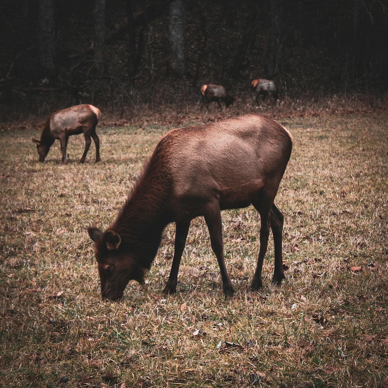
Arrive while the valley still holds its blue-gray dawn light — this is when the elk are most active and the gravel access road is yours alone. Park at Elk Pen Gap and let your eyes adjust; the tawny shapes emerge slowly from the tree line, hooves crunching softly through wet grass, and if you're lucky, a bull's distant bugle will carry across the mist. By 9am, cars start filling the pullouts, so this early window is when the valley feels most like it belongs only to you.
Continue slowly along the valley loop road toward Caton Cove, where the terrain opens into wide meadows and elk often congregate to graze through midday. This is less about a single stop and more about unhurried movement — pull over often, sit with the quiet, and notice how the rhododendron thickets frame every view. It's a soft, solitary rhythm well-suited to a solo traveler settling into trip mode.
Dawn breaks cool and quiet over Cataloochee, mist clinging low to the pastures as wild elk move like slow shadows through the grass. There's a stillness here that rewards early arrival — few sounds beyond hooves, wind, and the occasional distant bugle, the valley feeling entirely unclaimed by the day yet to come.
As the morning light softens into midday, the pace loosens further. A slow drive along the valley loop invites frequent stops — no rush, no itinerary pressure, just the pleasure of watching a landscape that hasn't changed much in a century reveal itself meadow by meadow.
With no dinner data mapped directly to Cataloochee, plan to settle into your base town — Waynesville, Cherokee, or Maggie Valley — for an early, easy dinner and a quiet night; mountain towns wind down early, so aim to eat by 7 or 7:30pm.
Day 2: Above the Clouds on the Ridge Line
A moderately active day combining the climb to Clingmans Dome with the long scenic drama of Newfound Gap Road, roughly 3-4 miles of walking total.
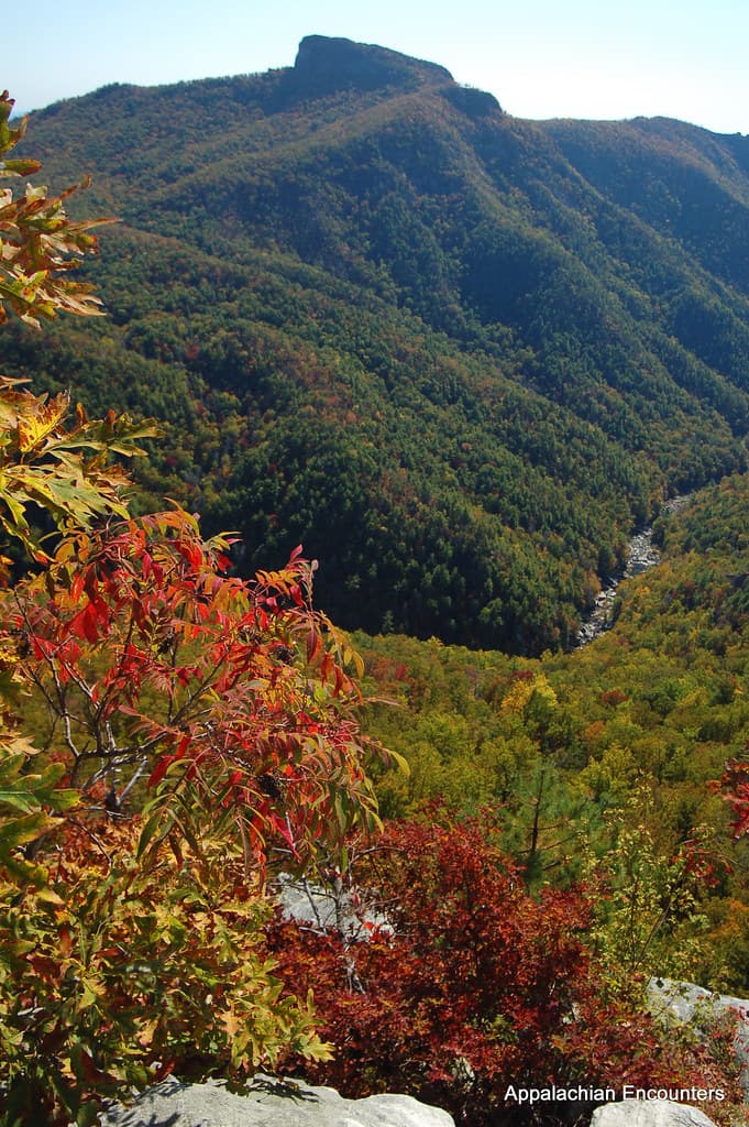
Arrive by 7:30am and the parking area is nearly empty — a rare gift at the park's highest point. The half-mile paved path up is steep enough to warm your legs and lungs, and as you climb into the fir forest, the air turns sharp and cold, scented with fraser fir and rain. At the summit's observation tower, if you're above the cloud layer, the view stretches into blue-hazed infinity; if fog rolls through, the tower itself feels suspended in white silence — either way, remarkable and quiet enough to feel like your own private discovery.

From the Dome, ease onto Newfound Gap Road for one of the most rewarding scenic drives in the park — 31 miles of ridge-hugging curves with pullouts at nearly every worthwhile vista. Stop at the Newfound Gap overlook, straddling the Tennessee-North Carolina line, and feel the wind funnel through the gap with real force. This slow, contemplative drive is well-suited to solo travelers — no need to coordinate stops, just pull over whenever a view demands it.

The climb to Clingmans Dome feels like ascending into another season entirely — cold, thin air, the scent of fir sharp in your nose, and if the timing's right, a view that opens suddenly above the cloud layer like a curtain pulled back. Arriving early means having the tower nearly to yourself before the crowds catch up by mid-morning.
The mood shifts from vertical effort to horizontal ease as Newfound Gap Road unspools its long ridge-line curves. This is a day of slowing down — pulling over often, letting the layered mountains do the talking, no urgency to reach any particular point by any particular time.
Return to town for an early dinner — mountain restaurants tend to wind down by 8pm, so aim to eat around 6:30 or 7. A quiet solo dinner and an early night suit tomorrow's cultural and trail-focused pace well.
Day 3: Cherokee Heritage and Hemlock Shade
A culturally rich, moderately active final day at the Oconaluftee gateway, blending history, milling heritage, and a rewarding waterfall hike totaling roughly 3-4 miles.
Start at the Oconaluftee overlook while morning mist still rises off the river — the light here is soft and diffuse, the air carrying the earthy scent of rhododendron and hemlock. This gateway spot is a gentle, low-effort way to ease into the day, offering a first taste of the Cherokee ancestral landscape that frames this whole corner of the park.

A short walk brings you to Mingus Mill, where the water wheel still turns with the same thunderous rumble it had 140 years ago. Step inside to feel the cool mist off the millrace and watch the massive stones grind corn into meal — a hypnotic, grounding stop that rewards patience and quiet observation, ideal for a solo traveler with no one to rush past the details.

By late morning, head to Laurel Falls for a moderate, deeply rewarding hike through old-growth hemlock. The trail's roar grows steadily louder as you approach, and the final reveal — cascading white water framed by towering trees — feels earned rather than given. Moss underfoot, cool spray in the air, and a satisfying midpoint to a day otherwise spent in quieter, slower stops.
The Oconaluftee gateway wakes slowly, mist rising off the river as the Cherokee ancestral landscape comes into soft focus. It's an easy, contemplative start — flat paths, gentle light, and a short walk to Mingus Mill, where the rumble of the water wheel and the scent of ground corn root you firmly in mountain history.
The day's energy shifts upward at Laurel Falls, where the trail's steady climb through hemlock forest builds anticipation with every step. The reveal of cascading water is the day's — and arguably the trip's — most cinematic moment, a fitting high note for a solo journey built on quiet discovery.
With the trail behind you, ease into a relaxed final evening in town — a casual dinner at one of the nearby Oconaluftee-area spots, then an early night. Mountain towns favor early closings, so plan to wrap dinner by 7:30 or 8pm and let the last night settle gently, mirroring the unhurried rhythm of the whole trip.
Want to tweak this trip?
Our AI planner can customize this itinerary to your exact dates, interests, and travel style.
Customize This ItineraryRestaurant details (hours, menus, availability) change frequently. Check current hours before visiting, especially in seasonal destinations.
Dietary compatibility tags are general guidance. If you have severe allergies, confirm directly with the restaurant.
Travel tips are general guidance, not professional safety advice. Check government advisories for latest information.
All prices are approximate and may vary seasonally.
Attractions in This Itinerary
More Itineraries for Great Smoky Mountains (NC side)
Explore North Carolina