3 DaysSolo Traveler8 Stops

Great Smoky Mountains (NC side), North Carolina

3-Day Itinerary for Solo Traveler

โ€œElk, Ridgelines & Millstones: 3 Days Solo in the Smokiesโ€

Elk, Ridgelines & Millstones: 3 Days Solo in the Smokies

Mist clings to Cataloochee's meadows at dawn, elk moving like ghosts through waist-high grass, while high above, Clingmans Dome pierces the cloud layer into blinding summer light. This corner of the Smokies rewards the solo traveler who rises early โ€” quiet trails, unhurried overlooks, and mountain towns where a stranger at the counter is just the start of a conversation.

At a Glance

Climate & Weather
Summer brings warm, humid days in the valleys (upper 70s-80sยฐF) and notably cooler, breezy conditions at elevation on Clingmans Dome โ€” pack a light rain shell, layers for the summit, and sun protection for exposed overlooks. Afternoon thunderstorms are common; mornings are your clearest window.
Getting Around
A personal vehicle is essential โ€” there's no public transit inside the park. Distances between clusters (Cataloochee, Clingmans Dome, Oconaluftee) run 45-75 minutes on winding mountain roads, so build in buffer time and expect slow, scenic driving rather than highway speeds.
Budget
Budget roughly $50-75/day for a solo traveler covering meals, gas, and minor park expenses โ€” the park itself has no entrance fee, so costs run mostly to food, coffee, and the occasional souvenir or gear rental.
Safety
Solo travelers should stick to marked trails, carry a paper map or downloaded offline map (cell service is unreliable), and never approach elk or bears โ€” both are common in Cataloochee and along roadsides. Let someone know your general hiking plan and expected return time, especially on Laurel Falls Trail before crowds arrive.
Connectivity
Cell coverage is sparse to nonexistent inside the park, improving near Cherokee and Waynesville. Download offline maps and any trail apps before you leave town; most lodging in gateway towns offers reliable WiFi.
Local Tips
Arrive at trailheads and overlooks by 7:30-8am in summer โ€” by mid-morning, parking lots fill and the light flattens; restaurants in small towns often close by 8pm and some shutter Mondays, so plan dinner accordingly; solo diners will find the most natural conversation at counter seating in local diners rather than sit-down tables.

Highlights

  • Wild elk grazing in dawn mist at Cataloochee Valley
  • Standing above the clouds at the highest point on the Appalachian Trail
  • 31 miles of ridgeline drama along Newfound Gap Road
  • A 140-year-old gristmill still grinding corn by water power
  • Laurel Falls' hemlock-shaded trail, best hiked before 8am
  • Cherokee heritage woven through the Oconaluftee gateway
  • Solo-friendly counters and communal tables in Waynesville and Cherokee

Day-by-Day Plan

Arrival & wildlife

Day 1: Into the Mist: Elk Valley Morning

A gentle first day centered on Cataloochee Valley's elk and pastoral quiet, with roughly 2 miles of easy walking and low physical demand to ease into mountain time.

Wear
Layers for cool dawn air warming into humid midday โ€” light long sleeves, sturdy walking shoes, and a hat for sun once the mist clears.
Budget
$35-50 (breakfast, gas, casual dinner)
7:00 AM - 9:30 AM
Cataloochee Valley (elk) ยท morning ยท 150 min ยท Cataloochee Valley

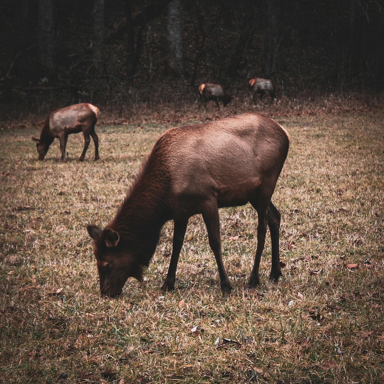
Arrive as the valley is still exhaling its overnight chill โ€” elk emerge from tree lines into open meadow, their breath visible in the cool air, and the only sounds are hooves in wet grass and the occasional distant bugle. Come before 8am and you may have the Elk Pen Gap overlook entirely to yourself; by mid-morning, cars line the pull-offs. This slow, solitary wildlife watching is an ideal way to shake off travel fatigue without demanding much of your legs.

Cataloochee Valley (elk)
Niki Clark / pexels (Pexels License)
Shoot from Elk Pen Gap overlook in the first hour of light, when mist backlights the herd and the valley glows gold.
Uneven roadside pull-offs; no paved paths, so wear grippy shoes for damp grass.
10 min drive โ€” A slow crawl along the valley's gravel loop road, windows down, scanning tree lines for movement.
9:30 AM - 10:30 AM
Cataloochee Valley (elk) ยท midday ยท 60 min ยท Cataloochee Valley

Continue the loop road toward Caton Cove, where the valley widens and elk often re-congregate to graze in open pasture through late morning before retreating to shade. This second, slower pass โ€” walking short stretches between pull-offs โ€” lets the pastoral stillness sink in: rhododendron thickets, weathered fence lines, the smell of damp earth long undisturbed.

Cataloochee Valley (elk)
Niki Clark / pexels (Pexels License)
Caton Cove Road offers wide meadow shots โ€” best with soft, high cloud cover rather than harsh midday sun.
Unpaved, uneven terrain; benches are sparse, so plan rest stops accordingly.
Lunch
Peter's Pancakes & Waffles $
Breakfast/Brunch ยท Near Oconaluftee, en route from Cataloochee
A relaxed, counter-friendly spot near Oconaluftee worth the detour if you're driving toward Cherokee for the evening โ€” solo diners can grab a stool and strike up conversation easily.
Optional detour: Cataloochee Valley (elk) โ€” Between morning viewing and midday drive
A third pass near Palmer Chapel at dusk can reveal elk again as they re-emerge to graze โ€” worth it if you're staying nearby overnight. Skip if: Skip if you're driving on to lodging in Waynesville or Cherokee, since the return trip from Cataloochee is long and best done in daylight.
If it rains: If rain moves in, elk viewing remains possible with mist adding atmosphere โ€” light rain won't spoil the experience. In heavier downpours, retreat toward Palmer Chapel or Abrams House for sheltered historic viewing, or head toward Cherokee for indoor options.

The valley reveals itself slowly: fog lifting off wet grass, dark shapes resolving into elk as the light strengthens. This is a morning for stillness rather than exertion โ€” find a quiet pull-off, settle in, and let the wildlife come into focus at its own pace.

As the herd retreats to shaded tree lines and the day warms, the pace shifts from wildlife watching to easy wandering โ€” a slow loop drive past historic homesteads, windows down, no urgency after the excitement of dawn.

Head toward your base โ€” Cherokee or Waynesville โ€” for a low-key dinner and early rest. This is the softest day of the trip; let jet lag and travel fatigue settle before tomorrow's elevation gain.

Elevation & panorama

Day 2: Above the Clouds: Ridgeline & Summit

A moderately active day covering roughly 4 miles combined walking across ridge overlooks and the summit trail, with noticeably cooler air at elevation.

Wear
A packable rain shell and warm layer for the summit โ€” temperatures at Clingmans Dome run 10-20 degrees cooler than the valley โ€” plus sturdy hiking shoes for the paved-but-steep summit trail.
Budget
$40-60 (breakfast, lunch, gas, minor snacks)
7:30 AM - 9:30 AM
Newfound Gap Road ยท morning ยท 120 min ยท Clingmans Dome High Country

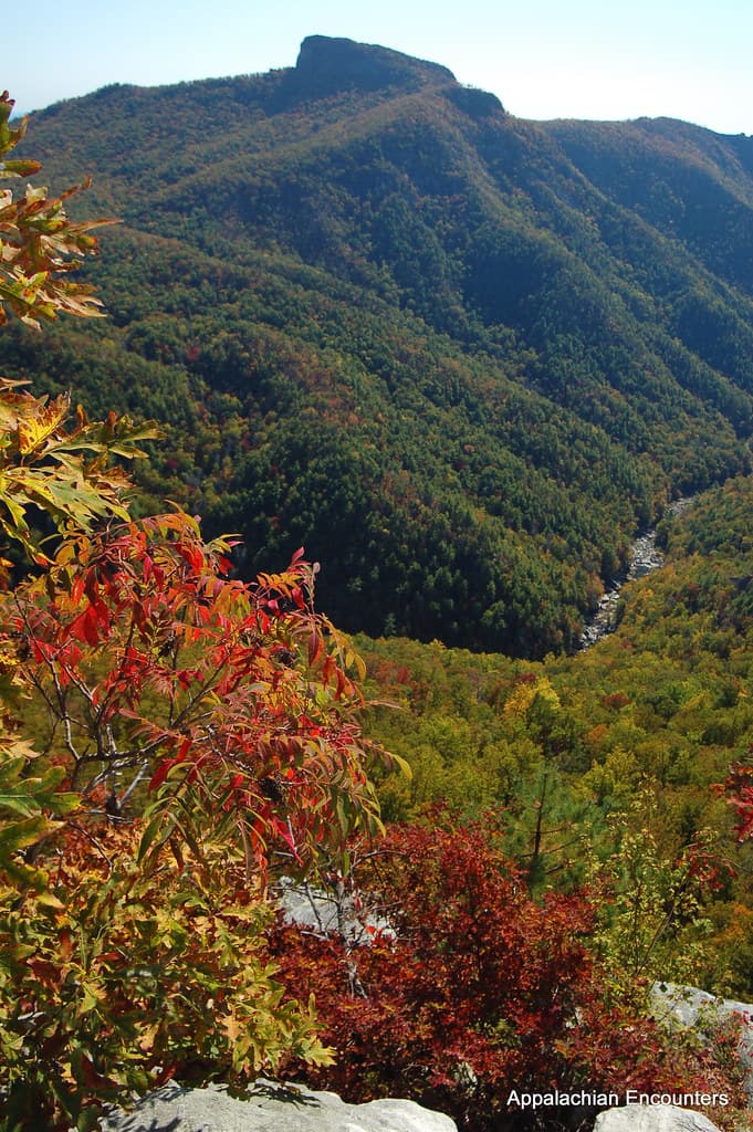
Drive the ridge road while it's still quiet โ€” cool air pours through the window, and each curve opens onto another blue-hazed layer of mountains stretching to the horizon. Stop at the Newfound Gap overlook, straddling the Tennessee-North Carolina line, where early light rakes across the ridgelines before the tour buses arrive. Arriving before 9am means empty pull-offs and unhurried photos.

Newfound Gap Road
Photo by Esteban Carriazo on Pexels
Shoot the Newfound Gap overlook state-line marker in early morning side light, when ridge layers show maximum depth and haze is minimal.
Overlooks are paved and wheelchair accessible, though walking between multiple stops adds distance.
15 min drive โ€” A climbing, curving drive up Clingmans Dome Road, forest thickening and temperature dropping with every switchback.
9:45 AM - 11:15 AM
Clingmans Dome ยท midday ยท 90 min ยท Clingmans Dome High Country

The steep, half-mile paved trail to the observation tower is a genuine climb โ€” lungs working, ears popping โ€” but the reward is standing above the cloud layer with 360-degree views spanning into multiple states. This is the emotional high point of the trip for a solo traveler: raw, physical, and quietly triumphant. Come by mid-morning before the parking area fills and the tower gets crowded with families.

Clingmans Dome
Famartin / openverse (by-sa)
Shoot from the tower's exterior platform โ€” arrive as early as possible for clear air before midday haze builds.
The trail to the tower is steep and unpaved in sections; not fully wheelchair accessible despite paved surface.
Lunch
Peter's Pancakes & Waffles $
Breakfast/Brunch ยท Near Oconaluftee, on the return route from Clingmans Dome
A hearty, casual stop back near Oconaluftee on your way down from the ridge โ€” good for refueling after the summit climb, with counter seating that invites conversation.
Optional detour: Newfound Gap Road โ€” Between Newfound Gap overlook and Clingmans Dome
The Clingmans Dome Road junction overlook offers a quieter, less-visited vista worth a short stop if you have extra time before the summit climb. Skip if: Skip if you want to reach Clingmans Dome before the mid-morning crowd surge โ€” every extra stop delays your summit window.
If it rains: If clouds descend and obscure the summit, retreat to lower elevations along Newfound Gap Road, where valley views often remain clear even when the ridge is fogged in. Morning fog frequently lifts by late morning, so a short wait can pay off.

The ridge road unspools in cool, clear air โ€” each overlook a fresh composition of layered mountains, best appreciated slowly and without an itinerary of stops that overpacks the morning.

The climb to Clingmans Dome shifts the day from scenic driving to physical effort โ€” a burning-lunged, satisfying ascent rewarded by views stretching far beyond the park's boundaries. Give yourself time to simply stand at the top before descending.

Drive back down into warmer air and quieter roads, dinner options thinning as small-town kitchens close early โ€” plan to eat by 7:30pm and spend the evening resting legs tired from the day's elevation gain.

Heritage & waterfalls

Day 3: Water, Wheels & Cherokee Ground

A varied final day mixing an early waterfall hike (about 2.6 miles round trip) with cultural and historic stops at Oconaluftee, totaling roughly 3-4 miles of walking.

Wear
Moisture-wicking layers and trail shoes with grip for the misty, sometimes slick Laurel Falls path; a light layer for the cooler river valley at Oconaluftee.
Budget
$35-55 (breakfast, lunch, small souvenirs)
7:00 AM - 8:30 AM
Laurel Falls Trail ยท morning ยท 90 min ยท Oconaluftee Gateway

Start before the trail wakes up โ€” before 8am, this popular path is often just you, the hemlocks, and the growing roar of water ahead. The paved trail winds through old-growth canopy before revealing cascading falls in a hemlock-framed amphitheater, mist settling on your skin. By 10am, this same trail is shoulder-to-shoulder; the early solo hiker gets a genuinely different experience.
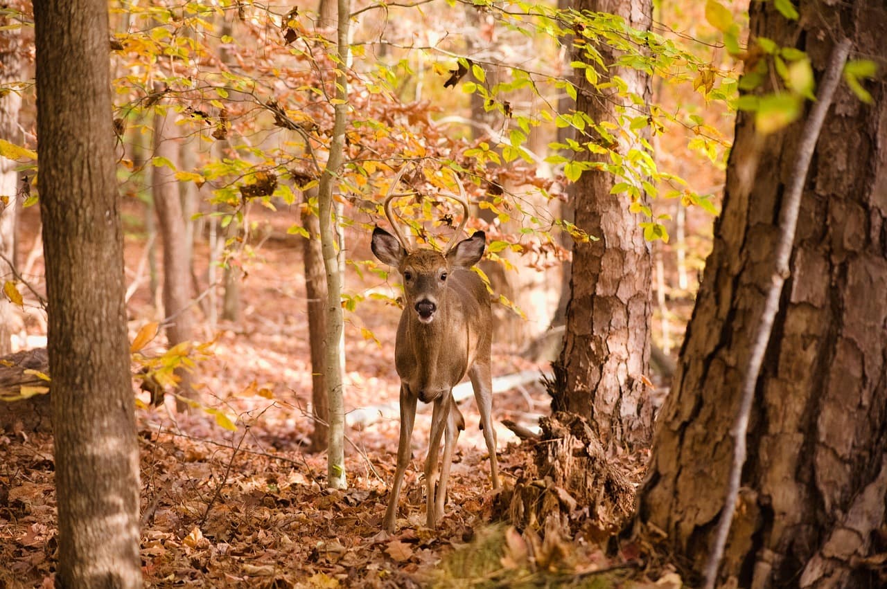
Laurel Falls Trail
Photo by jothamsutharson on Pixabay
Photograph from the base of the falls in early morning light, when mist and hemlock shadows create the most dramatic framing.
Trail is paved but uneven and sometimes slick with spray; not suitable for wheelchairs.
15 min drive โ€” A short, easy descent back toward the valley floor, trail mud giving way to paved road.
9:30 AM - 10:15 AM
Mingus Mill ยท midday ยท 45 min ยท Oconaluftee Gateway

The mill's water wheel groans and turns exactly as it has for 140 years, grinding corn into flour while the scent of fresh meal mixes with cool mist off the millrace. It's a gentle, low-energy stop after the morning hike โ€” a chance to rest legs while still engaging with the valley's history. Frequent benches make this an easy, unhurried visit.

Mingus Mill
Photo by Jteder on Pixabay
Interior shots of the grinding stones work best with the soft window light of late morning.
Fully wheelchair accessible with flat paths and frequent benches.
5 min drive โ€” A brief hop down the valley road, the river coming into view around the final bend.
10:30 AM - 11:15 AM
Oconaluftee ยท afternoon ยท 45 min ยท Oconaluftee Gateway

Close the trip where Cherokee ancestral lands meet the river โ€” mist still rising off the Oconaluftee River even at midday, ridgelines framing the valley in every direction. This is an easy, reflective final stop: short, accessible, and a fitting bookend to three days spent moving through the layered history and wildness of this side of the Smokies.

Oconaluftee
James St. John / openverse (by)
Shoot from the main overlook in late morning light, river in the foreground and ridges softened by rising mist.
Fully accessible with flat, paved paths and river views from the main overlook.
Breakfast
Peter's Pancakes & Waffles $
Breakfast/Brunch ยท Near Oconaluftee
Fuel up before the Laurel Falls hike with a hearty breakfast at counter seating โ€” a good spot for solo travelers to chat with locals before an early trail start.
Lunch
Happy Garden Restaurant $
Chinese ยท Near Oconaluftee
A comfortable, casual option near Oconaluftee if you want something different from Appalachian comfort food after days of trail snacks.
El Cajelito $
Mexican ยท Near Oconaluftee
A flavorful, easy lunch stop with quick service โ€” good for solo travelers ready to relax after the morning's hike and mill visit.
Optional detour: Mingus Mill โ€” After Laurel Falls Trail and before Oconaluftee
A restful, low-energy historic stop that balances the physical exertion of the morning hike. Skip if: Skip if you're short on time and prioritize a longer, unhurried visit at Oconaluftee itself before departure.
If it rains: Laurel Falls becomes slick and hazardous in heavy rain โ€” if downpours are forecast, skip the hike and spend the morning at Mingus Mill and Oconaluftee instead, both of which remain fully accessible and atmospheric in mist and light rain.

The trail to Laurel Falls feels almost private in the first hour of light โ€” cool spray on your face, canopy dense overhead, the roar of falling water building with every switchback until the falls reveal themselves in full.

The pace slows deliberately: the mill's turning wheel and the river valley at Oconaluftee offer quiet, accessible closure to the trip, low-key enough to reflect on three days of elk, ridgelines, and rushing water before the drive home.

With the park behind you, spend the final evening in Cherokee or Waynesville over an unhurried dinner โ€” a fitting, relaxed close to a solo trip built around mountain time rather than a packed checklist.

Want to tweak this trip?

Our AI planner can customize this itinerary to your exact dates, interests, and travel style.

Customize This Itinerary
Good to Know

Restaurant details (hours, menus, availability) change frequently. Check current hours before visiting, especially in seasonal destinations.

Dietary compatibility tags are general guidance. If you have severe allergies, confirm directly with the restaurant.

Travel tips are general guidance, not professional safety advice. Check government advisories for latest information.

All prices are approximate and may vary seasonally.

We use cookies to improve your experience and analyze site usage. Essential cookies are always active. You can customize your preferences or accept all cookies. Cookie Policy