3 DaysTeen Families9 Stops

Great Smoky Mountains (NC side), North Carolina

3-Day Itinerary for Teen Families

Elk, Mist & High Ridges: 3 Days in the Smokies

Elk, Mist & High Ridges: 3 Days in the Smokies

Spring in the Smokies arrives in layers — fog pooling in the valleys at dawn, wildflowers pushing up through leaf litter, elk grazing like they own the place. This is a trip for families with teens who want real adventure without a forced march: wild animals, a mountaintop, a waterfall, and just enough solitude to make the phones go quiet on their own.

At a Glance

Climate & Weather
Spring means mild days (50s-60s°F) but cold mornings and unpredictable rain, especially at elevation where Clingmans Dome can be 10-20 degrees cooler and windy. Pack waterproof layers, a warm hat, and real hiking shoes — cotton won't cut it if a shower rolls through.
Getting Around
A personal vehicle is non-negotiable — there's no public transit inside the park. Cataloochee requires a slow, winding gravel-and-paved approach via Cove Creek Road; budget extra time. Newfound Gap Road connects the Oconaluftee and Clingmans Dome areas directly.
Budget
Plan roughly $60-90/day per person for food and incidentals; the park itself has no entrance fee, though a parking tag is required at developed areas (around $5/day or $40/year).
Safety
Elk and bears are common in Cataloochee and roadside meadows — keep at least 50 yards from elk (especially during spring calving) and never approach or feed wildlife. Trails can be slick with spring rain; stick to marked paths, and check park road status before heading to Clingmans Dome, which occasionally closes for weather.
Connectivity
Cell service is unreliable to nonexistent throughout most of the park, including Cataloochee and the Clingmans Dome summit. Download offline maps before you go and expect a genuinely disconnected day — teens included.
Local Tips
Arrive at trailheads and overlooks before 9am — spring shoulder-season crowds build fast by midmorning on weekends. Many restaurants in Cherokee and Waynesville close by 8pm and some shut Mondays, so plan dinner timing accordingly. Bring layers you can shed — mornings in the 40s can become 65°F afternoons.

Highlights

  • Wild elk grazing at dawn in Cataloochee Valley
  • Standing above the clouds at Clingmans Dome
  • 31 miles of ridge-line drama on Newfound Gap Road
  • A working 1886 gristmill still grinding corn
  • Laurel Falls — a reward hike the whole family can handle
  • Cherokee heritage at the Oconaluftee gateway

Day-by-Day Plan

Wildlife & Arrival

Day 1: Into the Valley: Elk at Dawn

A gentle first day centered on Cataloochee Valley's wild elk and pastoral quiet, with minimal walking (under 2 miles) to ease into mountain time.

Wear
Layers — a warm base layer for the cool morning drive, a light rain jacket, sturdy walking shoes, and binoculars if you have them.
Budget
$50-70 for the day (mostly meals; elk viewing is free)
7:30 AM - 9:30 AM
Cataloochee Valley (elk) · morning · 120 min · Cataloochee Valley

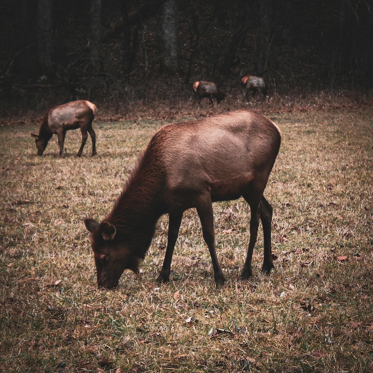
Arrive while the valley is still holding its breath — mist clinging to the grass, the occasional low bugle of a bull elk cutting through the quiet. This is wild elk country, reintroduced here decades ago, and dawn is when they're most active and least skittish, grazing in open meadows just yards from the pull-offs. Teens will appreciate the real wildness of it — no fences, no guarantees, just patience and quiet.

Cataloochee Valley (elk)
Niki Clark / pexels (Pexels License)
Shoot from Caton Cove Road where the valley widens — soft morning light and elk silhouettes against the mist make for the best frames.
Roadside viewing is possible without walking far, but the terrain isn't wheelchair accessible and paths are uneven.
5 min driveA short crawl along the valley loop road, windows down, scanning the tree line for movement
9:30 AM - 11:00 AM
Cataloochee Valley (elk) · midday · 90 min · Cataloochee Valley

Extend the morning with a slow loop past Palmer Chapel and the old homesteads scattered through the valley — weathered wood, quiet cemeteries, the sense of a community that vanished but left its bones behind. It's a good stretch for teens to wander a little on their own between structures while parents linger over the history.

Cataloochee Valley (elk)
Niki Clark / pexels (Pexels License)
Palmer Chapel against the tree line works well in flat midday light — less dramatic, but crisp and clean.
Homestead paths are uneven gravel and grass, not wheelchair friendly.
Optional detour: Cataloochee Valley (elk)After the morning elk viewing and before the midday homestead walk
A second pass through the valley near midday sometimes catches elk moving to shade — worth it if the family isn't rushed. Skip if: Skip if the morning session already delivered strong elk sightings and everyone's ready to move on toward town for lunch.
If it rains: Light rain actually enhances the elk-viewing mist and mood — stay put. If it turns to a heavy downpour, shift focus to the historic Palmer Chapel and Abrams House buildings, which offer some shelter and quieter exploration.

The drive into Cataloochee itself is part of the experience — a winding, narrow road that feels like driving back in time, ending in a valley that seems to exist outside the rest of the park's crowds. Roll the windows down before the last bend; the cold air and distant elk calls are the valley's way of saying hello.

After the elk sightings settle into memory, the pace slows further with a walk among the homesteads — an easy transition from wildlife-watching to quiet Appalachian history, giving legs (and attention spans) a rest before the drive back toward town.

With no dining data mapped directly to Cataloochee, plan the evening meal in Waynesville, Maggie Valley, or Cherokee depending on lodging — small mountain-town kitchens close early, so aim to be seated by 7pm. Let the day's quiet carry into an early night; tomorrow starts early again.

Summit & Scenic Drive

Day 2: Above the Clouds: Clingmans Dome & the Ridge Road

A moderately active day combining the park's highest peak with the sweeping overlooks of Newfound Gap Road, totaling roughly 3-4 miles of walking.

Wear
Warm layers for the summit (temperatures can be 15-20°F colder and windy), a rain shell, and broken-in hiking shoes for the paved-but-steep summit trail.
Budget
$60-80 for the day
45 min driveA winding pre-dawn drive up from the valley, temperature dropping noticeably as the road climbs toward the ridge
7:30 AM - 9:00 AM
Clingmans Dome · morning · 90 min · Clingmans Dome High Country

Arrive early and the observation tower can feel like it's yours alone — by 7:30am the parking area is nearly empty, and the half-mile paved climb to the summit rewards you with views stretching across both Tennessee and North Carolina, sometimes above the cloud layer itself. The air bites at this elevation even in spring; teens tend to get a kick out of the physical challenge of the steep grade paired with the payoff view. By 9am, the lot fills and the trail gets crowded.

Clingmans Dome
Famartin / openverse (by-sa)
Shoot from the tower's exterior platform right at sunrise — the silhouetted ridge lines and low light make this the single best photo op of the trip.
The path to the tower is paved but steep with a significant grade; wheelchair users can reach part of the trail but the full summit push is difficult.
15 min driveBack down the access road from the Dome parking area, rejoining the main ridge highway
9:30 AM - 11:30 AM
Newfound Gap Road · midday · 120 min · Clingmans Dome High Country

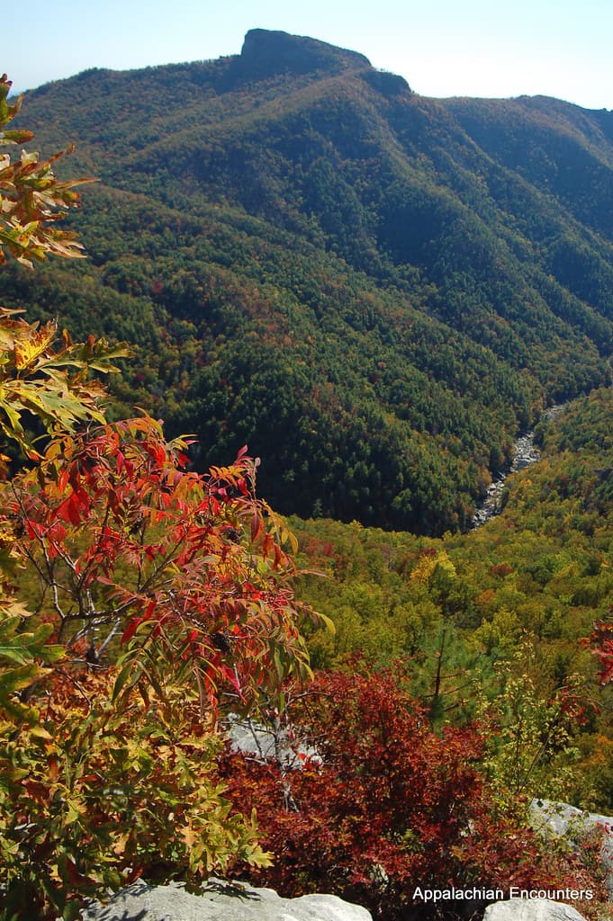
Descending from the Dome onto Newfound Gap Road turns the day into a rolling scenic drive — 31 miles of switchbacks with pull-offs at nearly every dramatic vista. Stop at the Newfound Gap overlook itself, straddling the Tennessee-North Carolina line, and let teens spot the layered blue ridges fading into haze. It's a good stretch for family banter in the car between short walks, rather than another demanding hike.

Newfound Gap Road
Photo by Esteban Carriazo on Pexels
The Newfound Gap overlook is strong at any time of day, but midmorning light keeps the haze layers crisp without harsh shadows.
Main overlooks are paved and wheelchair accessible; some viewpoints require short uneven walks.
10 min driveSlow curves with frequent brake-tapping for photo pull-offs — no rush today
12:00 PM - 1:30 PM
Newfound Gap Road · afternoon · 90 min · Clingmans Dome High Country

Continue the drive south with a couple more stops — Laurel Gap Shelter viewpoint and any pull-off that catches the eye — giving the day a lighter, low-pressure afternoon rhythm after the morning's summit climb. This is a good window for teens to control the playlist and call the next stop.

Newfound Gap Road
Photo by Esteban Carriazo on Pexels
Afternoon light flattens the ridge colors slightly, but it's a good time for wide shots showing the road's dramatic curves.
Same as morning — main pull-offs accessible, side trails less so.
Optional detour: Newfound Gap RoadBetween the Clingmans Dome summit and the main Newfound Gap overlook stop
An extra pull-off or two along the descent can catch fog lifting off the ridges in real time — dramatic and quick. Skip if: Skip additional stops if the family is cold or hungry after the summit climb — better to keep momentum toward lunch.
If it rains: If clouds sock in the summit, descend to the Newfound Gap area instead — lower elevation views often stay clear even when the Dome is fogged in. Fog frequently lifts by late morning, so a short wait can pay off.

The pre-dawn drive up to Clingmans Dome sets the tone for the whole day — cold, quiet, anticipatory. The climb itself is short but steep, and cresting into the open tower views after a burn in the legs is the kind of payoff that makes teens forget they were annoyed about the early wake-up.

Newfound Gap Road turns the rest of the day into an easy, scenic crawl rather than another hike — a welcome change of pace after the morning's elevation gain, with enough overlooks to keep everyone engaged without demanding much physically.

No dining data is mapped directly to this ridge-line cluster, so plan dinner back in Waynesville, Cherokee, or Maggie Valley depending on where you're staying — aim to arrive in town by 6:30-7pm since many mountain kitchens wind down service early.

Culture & Waterfall

Day 3: River Mist & Waterfall Light: The Oconaluftee Gateway

A moderate day blending Cherokee gateway history with a family-friendly waterfall hike, totaling around 3 miles of walking.

Wear
Layers again for the morning chill, waterproof shoes for the misty falls trail, and a light rain jacket just in case.
Budget
$50-75 for the day
8:00 AM - 8:45 AM
Oconaluftee · morning · 45 min · Oconaluftee Gateway

Start at the river overlook while the mist is still rising off the Oconaluftee — a quieter, more contemplative stop than the previous two days, and a good way to ease into the final day. The visitor center area sits at the cultural crossroads of the park, framed by Cherokee ancestral lands, and the river valley view is a gentle warm-up before the more active stops ahead.

Oconaluftee
James St. John / openverse (by)
The US 441 bridge crossing offers mist and morning light over the river — best captured before 9am while the light is still soft.
Fully wheelchair accessible with flat paths and frequent overlooks.
10 min driveA quick hop along the park road, river visible through the trees the whole way
9:00 AM - 9:45 AM
Mingus Mill · midday · 45 min · Oconaluftee Gateway

A short walk down to the still-operating 1886 gristmill offers a hands-on contrast to the previous two days' wilderness focus — the thunder of the water wheel, the dusty smell of ground corn, gears turning exactly as they did for mountain settlers generations ago. Teens tend to enjoy the mechanical spectacle of it more than a typical museum stop.

Mingus Mill
Photo by Jteder on Pixabay
Interior shots of the grinding stones work best with the soft window light of late morning.
Flat paths and frequent benches make this an easy, accessible stop for all mobility levels.
15 min driveA short scenic drive with the road narrowing as the forest thickens around you
11:00 AM - 1:00 PM
Laurel Falls Trail · afternoon · 120 min · Oconaluftee Gateway

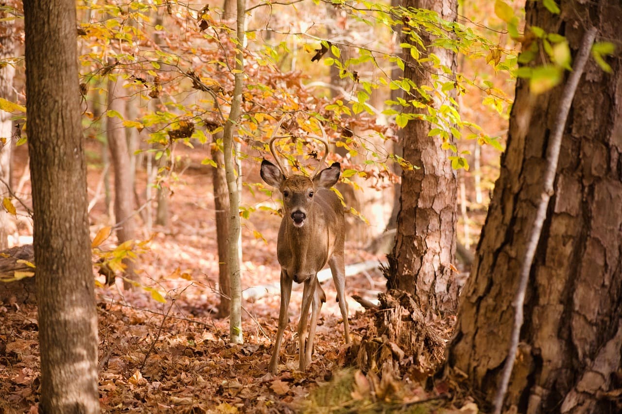
Close the trip with the reward hike — a mostly gentle, paved-in-parts trail that builds anticipation through old-growth hemlock before the falls reveal themselves in a burst of white water and spray. It's an ideal difficulty level for teens who want a bit of a challenge without a grueling climb, and the payoff view is genuinely Instagram-worthy. Arrive before 9am on busy days to have it quieter, though a late-morning start still works midweek in spring shoulder season.
Laurel Falls Trail
Photo by jothamsutharson on Pixabay
The base of the falls framed by hemlock branches is the classic shot — best light filters through midday when the sun is higher.
Trail is not wheelchair accessible and has uneven, sometimes slick footing — sturdy shoes recommended.
Breakfast
Peter's Pancakes & Waffles $
Breakfast/Brunch · Near Oconaluftee
A hearty, no-frills stack-and-syrup start before a day of hiking — reliable and filling for teens with big appetites.
Lunch
Hunt Brothers Pizza $
Pizza · Near Oconaluftee
Quick, casual, and teen-approved for a fast refuel after the falls hike.
Happy Garden Restaurant $
Chinese · Near Oconaluftee
A change of pace from mountain comfort food if the family wants variety.
El Cajelito $
Mexican · Near Oconaluftee
Casual and flavorful — a good contrast option if pizza feels repetitive by day three.
Optional detour: Mingus MillAfter Oconaluftee and before Laurel Falls Trail
A low-effort, high-interest stop that breaks up driving and hiking with hands-on history. Skip if: If the family is eager to beat crowds at Laurel Falls, it's reasonable to skip the mill and head straight to the trailhead.
If it rains: Both Oconaluftee and Mingus Mill remain enjoyable in light rain — mist over the river and mill machinery running in drizzle both add atmosphere. Laurel Falls Trail becomes slick and less advisable in heavy rain; if downpours hit, swap the hike for extended time at Mingus Mill or the Oconaluftee visitor center area instead.

The Oconaluftee river valley eases the group into the final day — mist, quiet water sounds, and a much gentler pace than the elk-spotting or summit climbs of the prior two days, letting everyone recalibrate before the mill and the falls.

The shift to Mingus Mill and then Laurel Falls Trail moves the day from passive viewing into hands-on history and then a rewarding, moderate hike — the kind of variety that keeps teens engaged without repeating the same activity twice in a row.

With lunch options available near Oconaluftee for a casual refuel, the evening is left open for a relaxed final dinner in Cherokee or Waynesville — a good time to let the trip's photos circulate on phones and the mood settle into satisfied tiredness before heading home or extending the stay.

Want to tweak this trip?

Our AI planner can customize this itinerary to your exact dates, interests, and travel style.

Customize This Itinerary
Good to Know

Restaurant details (hours, menus, availability) change frequently. Check current hours before visiting, especially in seasonal destinations.

Dietary compatibility tags are general guidance. If you have severe allergies, confirm directly with the restaurant.

Travel tips are general guidance, not professional safety advice. Check government advisories for latest information.

All prices are approximate and may vary seasonally.

We use cookies to improve your experience and analyze site usage. Essential cookies are always active. You can customize your preferences or accept all cookies. Cookie Policy