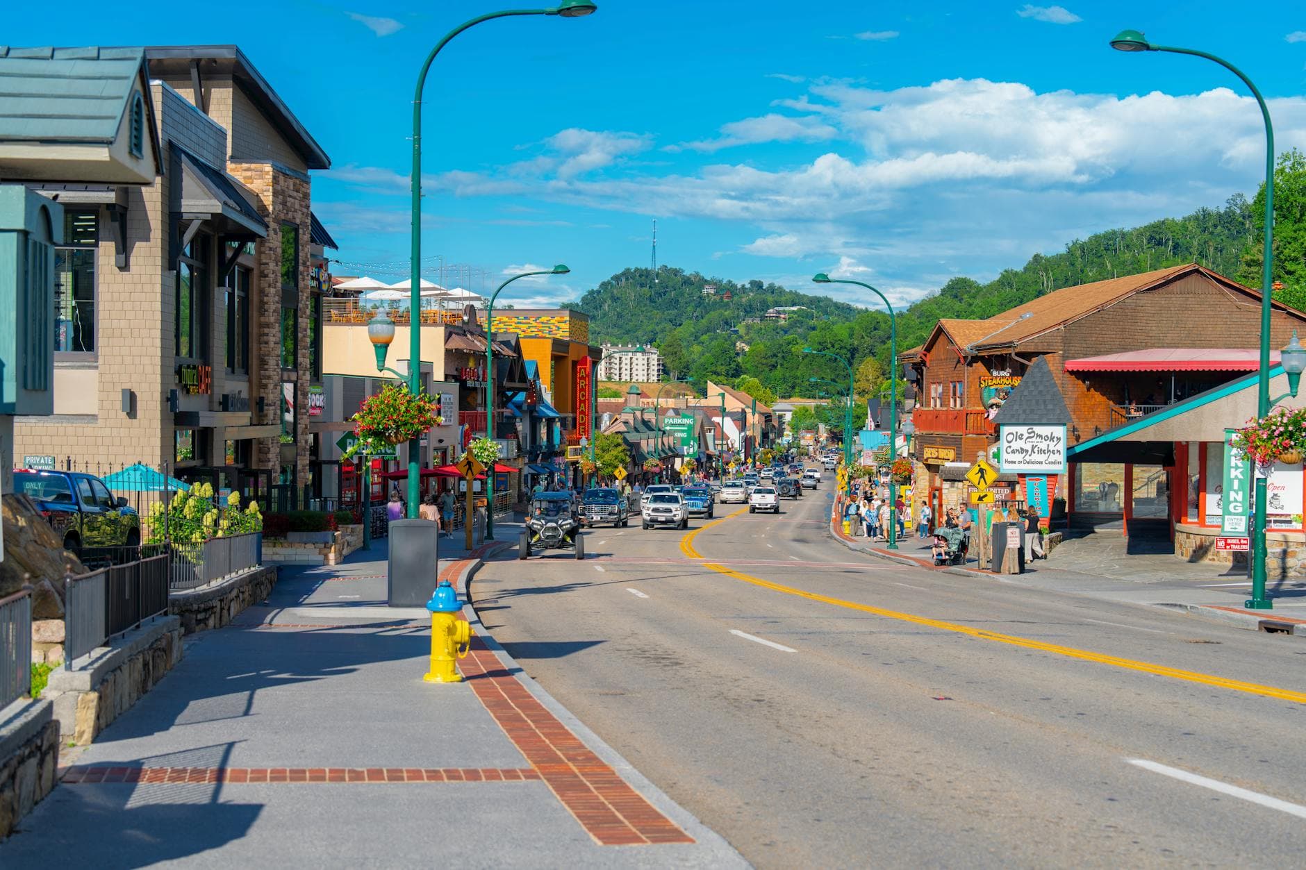
3 DaysActive Retirees3 Stops

Great Smoky Mountains (TN side), Tennessee

3-Day Itinerary for Active Retirees

Mist, Meadows & Mountain Light: 3 Days in the Smokies

Mist, Meadows & Mountain Light: 3 Days in the Smokies

Morning mist pools in the meadows of Cades Cove while deer graze in silence broken only by birdsong. Across three unhurried days, the Tennessee side of the Smokies unfolds at a walking pace — historic cabins, panoramic ridgelines, and a waterfall trail that rewards patience over speed.

At a Glance

Climate & Weather
Summer days stay pleasantly mild for elevation (highs near 63°F/17°C at higher points, warmer in the valleys), but afternoon thunderstorms are frequent and can roll in fast. Pack light layers, a packable rain jacket, and sturdy closed-toe walking shoes — temperatures can swing 10-15 degrees between valley floor and ridge.
Getting Around
A personal vehicle is essential; distances between clusters range from 20-45 minutes. Roads are paved and well-maintained, though Cades Cove Loop Road is one-way and can back up with wildlife-viewing traffic. Plan for slow, scenic driving rather than direct routes.
Budget
Budget roughly $70-100 per day per person for meals and incidentals; the park itself has no entrance fee, though a parking tag ($5/day, $15/week, or $40/year) is required as of recent policy.
Safety
Black bears are commonly seen, especially in Cades Cove — view from your vehicle or a safe distance and never approach for photos. Roads are winding with sudden weather changes possible at higher elevations, so allow extra time and check conditions before heading toward Newfound Gap.
Connectivity
Cell service is unreliable to nonexistent throughout most of the park, including Cades Cove and Newfound Gap. Download offline maps beforehand and let someone know your daily plans. Gatlinburg and Pigeon Forge have full service.
Local Tips
Arrive at Cades Cove or Laurel Falls by 8 AM in summer — parking lots fill and loop roads slow to a crawl by mid-morning. Pack a light picnic for flexibility, and keep a folding stool or two in the car for extended wildlife watching from pullouts.

Highlights

  • Sunrise wildlife watching along the Cades Cove loop road
  • Weathered pioneer cabins glowing amber in early light
  • Standing at 5,048 feet where two states meet at Newfound Gap
  • Cool hemlock-shaded overlooks with sweeping ridge views
  • A gentle woodland walk to Laurel Falls' cascading finale
  • Frequent benches and flat paths suited to a relaxed pace
  • Southern Appalachian comfort food after each day's exploring

Day-by-Day Plan

Arrival & gentle orientation

Day 1: Settling In: Cades Cove at First Light

A low-key first day centered on the flat, wildlife-rich Cades Cove loop with an easy pace and minimal walking (under 2 miles total).

Wear
Light layers, a brimmed hat, comfortable walking shoes, and a light rain shell in case of afternoon showers.
Budget
$60-80 per person including lunch, dinner, and park parking tag
7:30 AM - 10:30 AM
Cades Cove · morning · 180 min · Cades Cove Valley

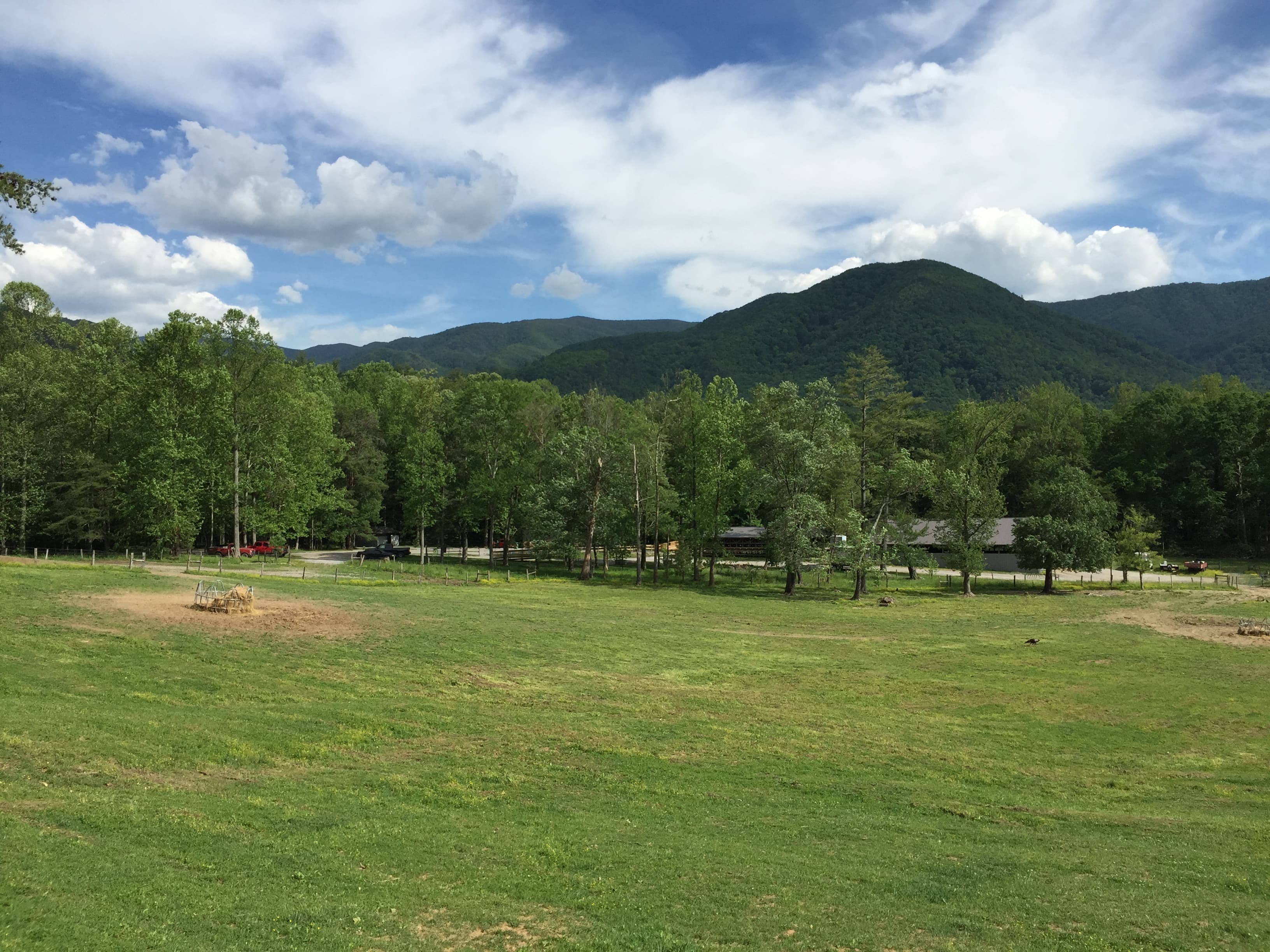
Arrive while the meadow grass is still silvered with dew and the loop road is nearly empty — deer often graze unbothered just yards from the pavement at this hour. The John Oliver Cabin appears out of the morning mist like a photograph coming into focus, and the pace here is entirely yours to set: pull over as often as you like, there's no itinerary but the one the valley suggests. By 9 AM the first tour vans begin arriving, so this early window is the quiet, contemplative version of Cades Cove.

Cades Cove
Famartin / openverse (by-sa)
Photograph the John Oliver Cabin between 7:30-8:30 AM when mist still clings to the ridge behind it — the light is soft and diffused, ideal for capturing texture in the weathered wood.
The loop road is paved and can be driven at a slow pace with frequent pullouts; benches are sparse, so consider bringing a folding seat for extended stops at cabins or the church.
If it rains: The 11-mile loop road remains drivable in light rain and mist actually enhances the atmosphere for photography of the cabins and distant ridgelines; heavy rain should prompt a slower drive-through only, skipping any walking near structures.

The day begins gently, with the loop road at Cades Cove offering an easy, scenic drive punctuated by frequent stops. Wildlife sightings are common in these early hours, and the historic cabins along the route provide a quiet sense of the valley's settler history without requiring any strenuous walking.

After a relaxed lunch, the afternoon is left open for rest — settle into your accommodation, unpack, and let the body adjust to any elevation or time changes. This is intentionally the lightest day of the trip, easing into the pace of the park.

Dinner in Gatlinburg or your gateway town of choice offers a chance to sample Southern Appalachian comfort fare after a day spent largely outdoors. An early night is well-earned, with tomorrow's start coming just as early as today's.

Panoramic elevation change

Day 2: To the Ridge: Newfound Gap and the High Country

A moderate day centered on Newfound Gap's high-elevation views, with light walking around the overlook (under 1 mile total).

Wear
Layered clothing is essential — temperatures at 5,048 feet run noticeably cooler than the valley; bring a warm layer, windbreaker, and closed-toe shoes.
Budget
$65-90 per person including lunch and dinner
45 min driveA winding ascent along Newfound Gap Road, with pullouts offering glimpses of the valley receding below — worth a brief stop at one of the lower overlooks if time allows.
8:00 AM - 9:30 AM
Newfound Gap · morning · 90 min · Newfound Gap & Central Ridge

The drive up gains nearly 3,000 feet, and the air noticeably thins and cools as spruce and fir replace the valley's hardwoods. Arrive by 8 AM and the parking area is calm, the Rockefeller Memorial plaza nearly empty, giving unhurried time to take in layered ridgelines fading into blue haze in every direction. By mid-morning tour buses and weekend crowds arrive in force, so this early window is the one to savor the silence and the wind moving through the firs.

Newfound Gap
James St. John / openverse (by)
Photograph the western overlook toward Sevier County in the first hour of light, when haze layers are most visible and crowds haven't yet filled the plaza.
The parking area and memorial plaza are paved and wheelchair accessible with frequent benches; the actual state-line gap crossing involves uneven ground and is not recommended for those with mobility concerns.
Optional detour: Alum Cave TrailAfter Newfound Gap and before returning to town
For those wanting a taste of the trail beyond the overlook, the lower portion offers hemlock-shaded walking with dramatic rock formations. Skip if: The trail is steep and rocky with uneven footing throughout, rated difficult for this demographic and not recommended beyond the first short stretch.
If it rains: Newfound Gap is frequently shrouded in cloud with near-zero visibility during storms — if this happens, retreat to lower elevations and consider Laurel Falls or a quiet stroll through Chimneys Picnic Area instead, or visit an indoor attraction in Gatlinburg.

The ascent to Newfound Gap offers a dramatic shift in scenery and climate, with cooling air and expansive views rewarding an early start. The overlook and memorial plaza provide ample flat, accessible space to linger over the panorama without any strenuous walking required.

Descend back toward the valley floor at a relaxed pace, with time built in for a leisurely lunch and rest before the afternoon winds down. The change in elevation and temperature makes for a good midday pause to recalibrate.

An early dinner allows for a full evening of rest, letting the day's elevation gain settle before tomorrow's waterfall walk. Keep the evening low-key, given the more active morning.

Waterfall & woodland

Day 3: Falling Water: A Gentle Walk to Laurel Falls

A moderate walking day (roughly 2.6 miles roundtrip) centered on the accessible, popular Laurel Falls trail, paced slowly with rest stops.

Wear
Sturdy closed-toe shoes with good tread (the paved trail can be slick near the falls), a light layer for shifting temperatures, and a rain shell given summer's afternoon storm pattern.
Budget
$60-85 per person including lunch and a farewell dinner
30 min driveA short, winding drive from town along Little River Road, with glimpses of the river running alongside for much of the route.
7:30 AM - 9:30 AM
Laurel Falls · morning · 120 min · Laurel Falls & Eastern Valleys

Arriving before 8 AM means a mostly empty parking lot and a trail still cool with morning shade — by midday this 2.6-mile roundtrip walk draws crowds shoulder to shoulder. The paved-but-uneven path winds gradually upward through dense canopy, the sound of falling water growing louder with each switchback until the cascade itself comes into view, spray catching the early light. Take this one slowly, with rest stops at the switchback overlooks — there's no need to reach the base quickly when the journey through filtered green light is half the reward.
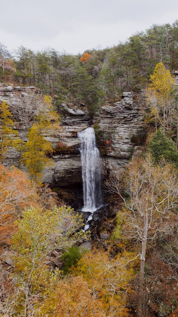
Laurel Falls
Kelly / pexels (Pexels License)
The base of the falls offers the closest vantage with spray in the foreground — visit before 9 AM for softer light and far fewer people in the frame.
The trail is paved but steep and uneven in sections with no benches; not recommended for those using mobility aids or with significant walking limitations. Consider the view from the first quarter-mile as a shorter alternative if the full distance feels ambitious.
Optional detour: Chimneys Picnic AreaBefore Laurel Falls, as a brief morning stop on the way
A quick, flat roadside stop to see the weathered stone chimney structures against open pasture, requiring minimal walking. Skip if: If time is limited, this stop can be skipped entirely in favor of arriving at Laurel Falls as early as possible to beat the crowds.
If it rains: The Laurel Falls trail becomes slick and hazardous in heavy rain — if storms roll in, postpone the hike and instead enjoy a scenic drive through Cades Cove Valley, where the loop road remains drivable and mist adds atmosphere to the historic structures.

The walk to Laurel Falls unfolds slowly through cool, shaded forest, with the sound of the cascade building gradually as the trail climbs. Frequent pauses at the switchbacks make this manageable at a relaxed pace, with the falls themselves offering a satisfying, photogenic finale.

After the walk back down, a quiet lunch offers a chance to rest before the trip winds toward its close. The afternoon can be left unstructured — a final drive through a favorite cluster, or simply relaxing before the evening.

A final evening meal in the gateway town closes out the trip on a comfortable note, with Southern comfort fare and a relaxed atmosphere fitting the unhurried rhythm of the past three days.

Want to tweak this trip?

Our AI planner can customize this itinerary to your exact dates, interests, and travel style.

Customize This Itinerary
Good to Know

Restaurant details (hours, menus, availability) change frequently. Check current hours before visiting, especially in seasonal destinations.

Dietary compatibility tags are general guidance. If you have severe allergies, confirm directly with the restaurant.

Travel tips are general guidance, not professional safety advice. Check government advisories for latest information.

All prices are approximate and may vary seasonally.

We use cookies to improve your experience and analyze site usage. Essential cookies are always active. You can customize your preferences or accept all cookies. Cookie Policy